Latitude: 51.2742 / 51°16'27"N
Longitude: 1.3405 / 1°20'25"E
OS Eastings: 633093
OS Northings: 158087
OS Grid: TR330580
Mapcode National: GBR X18.3Q6
Mapcode Global: VHLGS.671J
Plus Code: 9F3378FR+M6
Entry Name: 26, King Street
Listing Date: 23 April 1976
Grade: II
Source: Historic England
Source ID: 1069636
English Heritage Legacy ID: 177493
ID on this website: 101069636
Location: Sandwich, Dover, Kent, CT13
County: Kent
District: Dover
Civil Parish: Sandwich
Built-Up Area: Sandwich
Traditional County: Kent
Lieutenancy Area (Ceremonial County): Kent
Tagged with: Building
1. 5275 KING STREET (South-West Side) No 26 TR 3358 1/288
II GV
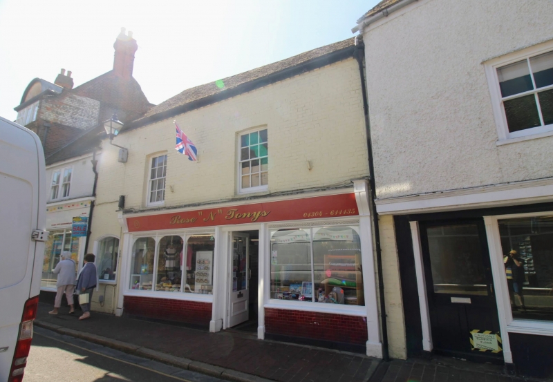
2. Timber framed building probably early C17 behind a brick facade of the C19 now painted. 2 sash windows, glazing bars complete on 1st floor and flat arches over. Brick dentil course and modern shop fronts.
Nos 24 to 28 (even) form a group.
Listing NGR: TR3308858084
External links are from the relevant listing authority and, where applicable, Wikidata. Wikidata IDs may be related buildings as well as this specific building. If you want to add or update a link, you will need to do so by editing the Wikidata entry.


Other nearby listed buildings