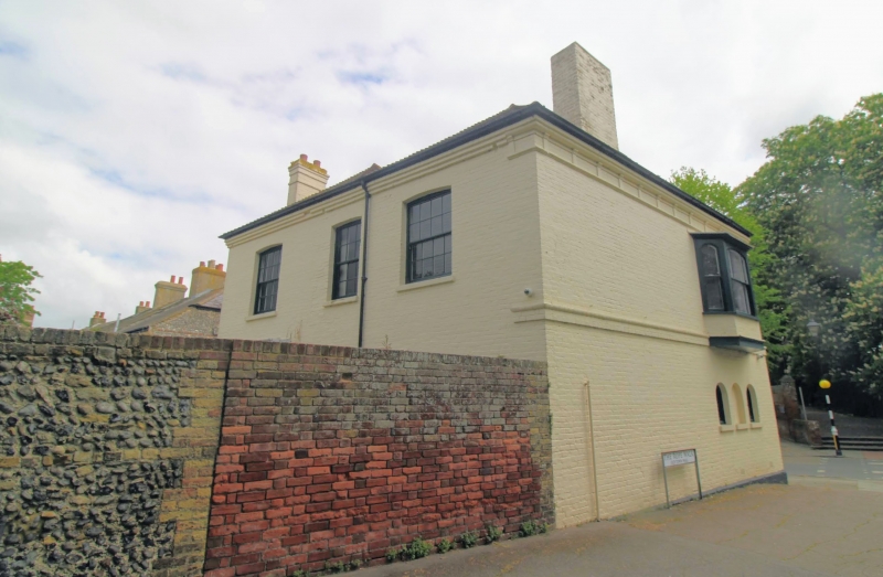
Latitude: 51.272 / 51°16'19"N
Longitude: 1.3407 / 1°20'26"E
OS Eastings: 633118
OS Northings: 157842
OS Grid: TR331578
Mapcode National: GBR X18.3T6
Mapcode Global: VHLGS.6946
Plus Code: 9F3378CR+R7
Entry Name: 86, New Street
Listing Date: 23 April 1976
Grade: II
Source: Historic England
Source ID: 1069592
English Heritage Legacy ID: 177590
ID on this website: 101069592
Location: Sandwich, Dover, Kent, CT13
County: Kent
District: Dover
Civil Parish: Sandwich
Built-Up Area: Sandwich
Traditional County: Kent
Lieutenancy Area (Ceremonial County): Kent
Tagged with: Pub
This list entry was subject to a Minor Amendment on 14 May 2025 to update the Name and Address and reformat the text to current standards
TR 3357 NW
2/336
NEW STREET (south West side)
No 86
(Formerly listed as No 86 (The Sandwich Arms Public House))
II
Circa 1845 facade to New Street. Two storey painted brick building with plain tiled roof. Cornice of projecting brick and tryglyphs carried into small gable over front entrance on corner. String course and plinth. Semi-circular brick arches over windows and blind windows. Front entrance door glazed in six squares with moulded panel below and semi- circular fanlight over, all glazing bars complete. Two windows to New Street semi-circular on ground floor and glazing bars complete. Side door as front door. C17 wing at the rear from which the pitched roof has been removed. Three windows with glazing bars forming 20 squares each box sash.
Listing NGR: TR3311857842
External links are from the relevant listing authority and, where applicable, Wikidata. Wikidata IDs may be related buildings as well as this specific building. If you want to add or update a link, you will need to do so by editing the Wikidata entry.


Other nearby listed buildings