Latitude: 51.2727 / 51°16'21"N
Longitude: 1.3384 / 1°20'18"E
OS Eastings: 632955
OS Northings: 157915
OS Grid: TR329579
Mapcode National: GBR X18.37D
Mapcode Global: VHLGS.48YN
Plus Code: 9F3378FQ+39
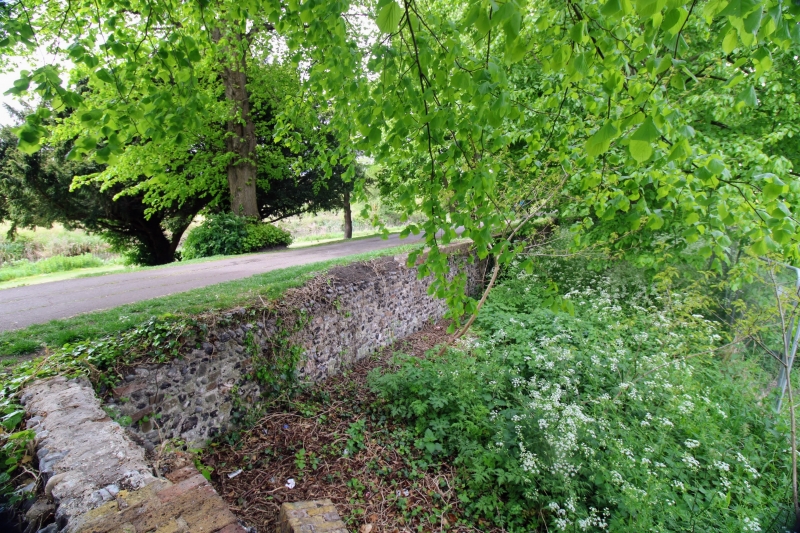
Entry Name: Boundary Walling Midway Along the Rope Walk Between Woodnesborough Road and New Street
Listing Date: 19 May 1950
Grade: II
Source: Historic England
Source ID: 1069561
English Heritage Legacy ID: 177620
ID on this website: 101069561
Location: Sandwich, Dover, Kent, CT13
County: Kent
District: Dover
Civil Parish: Sandwich
Built-Up Area: Sandwich
Traditional County: Kent
Lieutenancy Area (Ceremonial County): Kent
Tagged with: Wall
1. 5275 ROPE WALK
Boundary walling midway along the Rope Walk between Woodnesborough Road and New Street TR 3257 4/198F 19.5.50.
II
2. Approximately 35 ft of flint walling having some stone and a brick on edge coping of mid C19 date with a return length of walling at right angles to the stream. It is upon the line of the mediaeval town wall and is probably of C14 origin. A.M.
Listing NGR: TR3295557914
External links are from the relevant listing authority and, where applicable, Wikidata. Wikidata IDs may be related buildings as well as this specific building. If you want to add or update a link, you will need to do so by editing the Wikidata entry.


Other nearby listed buildings