Latitude: 51.2243 / 51°13'27"N
Longitude: 0.4298 / 0°25'47"E
OS Eastings: 569767
OS Northings: 150044
OS Grid: TQ697500
Mapcode National: GBR NQC.1JB
Mapcode Global: VHJMK.DHL8
Plus Code: 9F326CFH+PW
Entry Name: Bridge House
Listing Date: 23 May 1967
Last Amended: 14 October 1987
Grade: II
Source: Historic England
Source ID: 1069033
English Heritage Legacy ID: 174940
ID on this website: 101069033
Location: Yalding, Maidstone, Kent, ME18
County: Kent
District: Maidstone
Civil Parish: Yalding
Built-Up Area: Yalding
Traditional County: Kent
Lieutenancy Area (Ceremonial County): Kent
Church of England Parish: Yalding St Peter and St Paul
Church of England Diocese: Rochester
Tagged with: House
YALDING HIGH STREET TQ 6950 (West side) 6/142 Bridge House (formerly listed under High Street, 23-5-67 North Arm) GV II
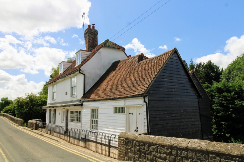
House. (Early?) C18. Ground floor painted brick, first floor rendered to front, weatherboarded to left gable end. Plain tile roof. 2 storeys, attic and basement. Land slopes away to rear. Boxed eaves. Half-hipped roof. Red and grey brick ridge stack towards centre. Two flat-roofed dormers with paned lights. Regular 2-window front of four-pane sashes. Sixteen-pane light with shutters to left end of ground floor, and small multipane shop window to right. Ribbed door to right of centre (to left end of shop window), with small nine-pane light to left of it. Continuous leaded pentice over ground-floor windows and door. Short gabled rear return wing to left, in similar materials, with lower ridge and gable end stack. Low parallel rear range to rest of main range, with tarred weatherboarding and gabled plain tile roof. Single-storey weatherboarded section to right with gabled plain tile roof, boarded doors to right, and painted garage doors. Interior not inspected. Situated on west side of causeway section of Town Bridge; the only building on the bridge.
Listing NGR: TQ6976950047
External links are from the relevant listing authority and, where applicable, Wikidata. Wikidata IDs may be related buildings as well as this specific building. If you want to add or update a link, you will need to do so by editing the Wikidata entry.


Other nearby listed buildings