Latitude: 50.9844 / 50°59'3"N
Longitude: 0.9382 / 0°56'17"E
OS Eastings: 606322
OS Northings: 124667
OS Grid: TR063246
Mapcode National: GBR T07.B02
Mapcode Global: FRA D6VH.WWY
Plus Code: 9F22XWMQ+Q7
Entry Name: Mulberry House
Listing Date: 28 August 1951
Grade: II
Source: Historic England
Source ID: 1069000
English Heritage Legacy ID: 175055
ID on this website: 101069000
Location: New Romney, Folkestone and Hythe, Kent, TN28
County: Kent
District: Folkestone and Hythe
Civil Parish: New Romney
Built-Up Area: New Romney
Traditional County: Kent
Lieutenancy Area (Ceremonial County): Kent
Tagged with: House
1. 1449 LION'S ROAD (South Side)
Mulberry House TR 02 SE 2/62 28.8.5l. II
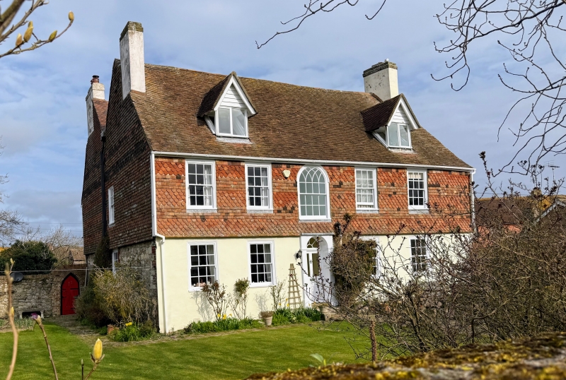
2. C18. 2 parallel ranges. 2 storeys and attics, stuccoed and grooved in imitation of masonry, Tiled roof with wooden bracket eaves cornice. 5 sashes with glazing bars intact. Doorcase with shallow open pediment, pilasters, semi-circular fanlight and door of 6 fielded panels. Right side elevation has a ground floor of stone rubble and 1st floor is hung with curved tiles. The left side extension to the house has now been demolished. The rear elevation has a stuccoed ground floor and 1st floor hung with curved tiles. 2 C19 hipped dormers. 5 sashes set in moulded architraves and a fine central Gothic-headed sash.
Listing NGR: TR0632224670
External links are from the relevant listing authority and, where applicable, Wikidata. Wikidata IDs may be related buildings as well as this specific building. If you want to add or update a link, you will need to do so by editing the Wikidata entry.


Other nearby listed buildings