Latitude: 52.8467 / 52°50'48"N
Longitude: -1.3059 / 1°18'21"W
OS Eastings: 446846
OS Northings: 327910
OS Grid: SK468279
Mapcode National: GBR 7HD.DPM
Mapcode Global: WHDH8.XQB1
Plus Code: 9C4WRMWV+MM
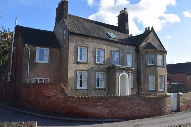
Entry Name: The Old Vicarage
Listing Date: 16 January 1989
Grade: II
Source: Historic England
Source ID: 1068700
English Heritage Legacy ID: 358194
ID on this website: 101068700
Location: Lockington, North West Leicestershire, DE74
County: Leicestershire
District: North West Leicestershire
Civil Parish: Lockington-Hemington
Traditional County: Leicestershire
Lieutenancy Area (Ceremonial County): Leicestershire
Church of England Parish: Lockington St Nicholas
Church of England Diocese: Leicester
Tagged with: Clergy house
LOCKINGTON-HEMINGTON CHURCH STREET SK 42 NE (Lockington) 3/147 The Old Vicarage GV II
House. Mid C19 re-modelling of C18 building, possibly with earlier origins. Late C19 extension to right. Roughcast, tiled roof, flanking roughcast chimneys. 2 storeys and attic. Main block to centre has: 4 bays of late C19-C20 sashes without glazing bars, all in rendered architrave surrounds. C20 skylight in third bay. This bay also has 4-panelled door with blind panelled fanlight and wooden architrave frame. Mid C19 rendered porch wih semicircular arch and keyblock, flanking Doric pilasters, and moulded cornice. Lower 2-storey bay set back to left with C20 wooden casements, the ground floor window with 3 leaded lights. C19 extension to right with slightly projecting coped gable and 2-storey canted bay window. Rear has irregular windows, one a tall staircase window. Included for group value.
Listing NGR: SK4684627910
External links are from the relevant listing authority and, where applicable, Wikidata. Wikidata IDs may be related buildings as well as this specific building. If you want to add or update a link, you will need to do so by editing the Wikidata entry.


Other nearby listed buildings