Latitude: 53.5167 / 53°31'0"N
Longitude: -2.7201 / 2°43'12"W
OS Eastings: 352346
OS Northings: 402469
OS Grid: SD523024
Mapcode National: GBR 9WFS.W2
Mapcode Global: WH86S.5VYW
Plus Code: 9C5VG78H+MW
Entry Name: Bispham Hall
Listing Date: 23 August 1966
Grade: II*
Source: Historic England
Source ID: 1068434
English Heritage Legacy ID: 213588
ID on this website: 101068434
Location: Brownlow, Wigan, Greater Manchester, WN5
County: Wigan
Electoral Ward/Division: Orrell
Parish: Non Civil Parish
Traditional County: Lancashire
Lieutenancy Area (Ceremonial County): Greater Manchester
Church of England Parish: Orrell St Luke
Church of England Diocese: Liverpool
Tagged with: English country house
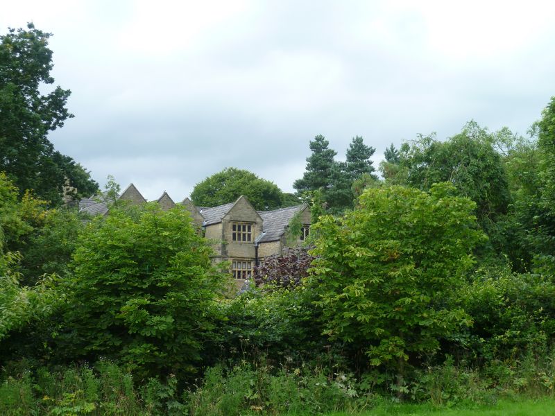
BILLINGE-WITH-WINSTANLEY CRANK ROAD SD 50 SW (west side) 8/31 Bispham Hall 23.8.66 - II* Large house. 1573 with later extensions. Dressed stone with ashlar dressings, roof now gone (1986). 3 storeys, 5 gabled bays, the 2nd and 4th bays project, the 1st and 5th bays project further and are wider. Base, quoins and some remaining coping. Most windows have double-chamfered mullions, probably restorations, and label moulds; most windows of 5 lights with transom. Ground floor has blocked window to 2nd bay, inner returns of 1st, 2nd and 5th bays have 4-light ovolo-mullioned blind windows with painted glazing. 1st floor has 4-light window to 4th bay and ovolo- mullioned blind windows to inner returns of 1st, 2nd and 5th bays. 2nd floor windows have no transoms, apart from 4-light window to 4th bay. Round-headed entrance has impost blocks, now blocked, arms under label mould above. Gable to 5th bay has round feature in coping. Left return has projecting gabled bay with canted projecting centre originally with hipped roof and rainwater head dated 1727. Continuous label moulds to windows, those to ground floor with double- chamfered mullions of 2 lights with transom those to 1st floor similar, with ovolo mullions, 2nd floor windows are ovolo-mullioned but have no transoms. Projecting lateral stack to right. Right return has projecting lateral stack with blocked fire windows and later lean-to shed with crow- stepped gable to front. Projecting gabled bay has ovolo- mullioned windows, as has extension to right. Rear has later extensions and a truncated stack, some mullioned windows and round-headed opening. Interior not inspected, upper storeys destroyed by fire; Tudor-headed doorway visible on 2nd floor; said to have large fireplaces, staircase with turned balusters has probably not survived. Although extensively damaged, the hall remains one of the most complete survivals from the C16 in the historic county of Lancashire.
Listing NGR: SD5245502493
External links are from the relevant listing authority and, where applicable, Wikidata. Wikidata IDs may be related buildings as well as this specific building. If you want to add or update a link, you will need to do so by editing the Wikidata entry.


Other nearby listed buildings