Latitude: 53.3695 / 53°22'10"N
Longitude: -2.9302 / 2°55'48"W
OS Eastings: 338203
OS Northings: 386255
OS Grid: SJ382862
Mapcode National: GBR 7YZG.DV
Mapcode Global: WH87F.YKTP
Plus Code: 9C5V9399+RW
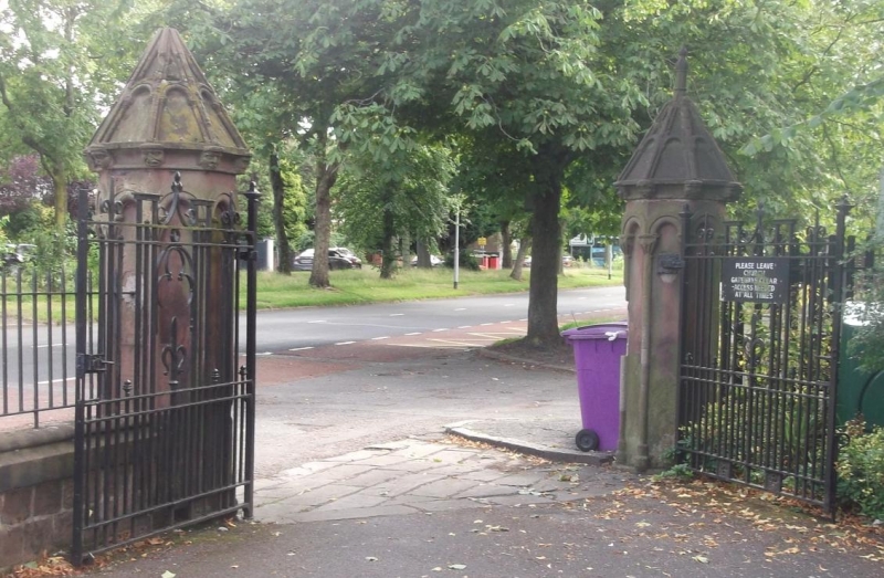
Entry Name: Gate Piers to St Anne's Church
Listing Date: 19 June 1985
Grade: II
Source: Historic England
Source ID: 1068406
English Heritage Legacy ID: 213626
ID on this website: 101068406
Location: Otterspool, Liverpool, Merseyside, L17
County: Liverpool
Electoral Ward/Division: Mossley Hill
Parish: Non Civil Parish
Built-Up Area: Liverpool
Traditional County: Lancashire
Lieutenancy Area (Ceremonial County): Merseyside
Church of England Parish: Aigburth St Anne
Church of England Diocese: Liverpool
Tagged with: Gatepost
SJ 38 NE AIGBURTH ROAD L17
7/35 Gate piers to Saint Anne's - church G.V. II
Gate piers. 1836. Cunningham and Holme. Romanesque. 4 stone piers, octagonal with arcading, cornices with corbels and panelled caps and finials.
Listing NGR: SJ3820386255
External links are from the relevant listing authority and, where applicable, Wikidata. Wikidata IDs may be related buildings as well as this specific building. If you want to add or update a link, you will need to do so by editing the Wikidata entry.


Other nearby listed buildings