Latitude: 53.3912 / 53°23'28"N
Longitude: -2.9365 / 2°56'11"W
OS Eastings: 337814
OS Northings: 388668
OS Grid: SJ378886
Mapcode National: GBR 7GV.RB
Mapcode Global: WH87F.V1T2
Plus Code: 9C5V93R7+F9
Entry Name: Presbytery Adjoining Church of St Clare
Listing Date: 28 June 1952
Grade: II
Source: Historic England
Source ID: 1068394
English Heritage Legacy ID: 213703
ID on this website: 101068394
Location: St Claire's Church, Liverpool, Merseyside, L17
County: Liverpool
Electoral Ward/Division: Greenbank
Parish: Non Civil Parish
Built-Up Area: Liverpool
Traditional County: Lancashire
Lieutenancy Area (Ceremonial County): Merseyside
Church of England Parish: Toxteth Park St Agnes and St Pancras
Church of England Diocese: Liverpool
Tagged with: Clergy house
SJ 3788 ARUNDEL AVENUE L17 33/100 Presbytery ad- 28.6.52 joining Church of St. Clare G.V. II
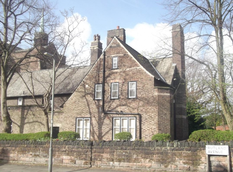
Presbytery. 1890. L. Stokes. Brick with slate roof. Runs north from the chancel of church with 2 large windows to each floor. These are casements, with glazing bars forming an arch in the centre, but flat-headed with a course of bricks on edge over, to ground floor, and simpler windows to 1st floor. Decoration is confined to the stone-dressed doorway which has a deep splay and sharply pointed arch. The hood mould ends in stops carved with date. Door with ornamental hinges, pierced in a rose pattern for glazing. External stack on gable and rear gabled wing with swept roofs but all simply detailed.
Listing NGR: SJ3781488671
External links are from the relevant listing authority and, where applicable, Wikidata. Wikidata IDs may be related buildings as well as this specific building. If you want to add or update a link, you will need to do so by editing the Wikidata entry.


Other nearby listed buildings