Latitude: 53.3562 / 53°21'22"N
Longitude: -2.9202 / 2°55'12"W
OS Eastings: 338847
OS Northings: 384768
OS Grid: SJ388847
Mapcode National: GBR 8Y1M.KL
Mapcode Global: WH87G.3WPX
Plus Code: 9C5V934H+FW
Entry Name: Stapley
Listing Date: 14 March 1975
Grade: II
Source: Historic England
Source ID: 1068191
English Heritage Legacy ID: 214177
ID on this website: 101068191
Location: Grassendale Park, Liverpool, Merseyside, L19
County: Liverpool
Electoral Ward/Division: Cressington
Parish: Non Civil Parish
Built-Up Area: Liverpool
Traditional County: Lancashire
Lieutenancy Area (Ceremonial County): Merseyside
Church of England Parish: Grassendale St Mary the Virgin
Church of England Diocese: Liverpool
Tagged with: Building
SJ 3884 GRASSENDALE PARK North Road (south side) L19 47/530 No. 37 (Stapley) 14.3.75 G.V. II
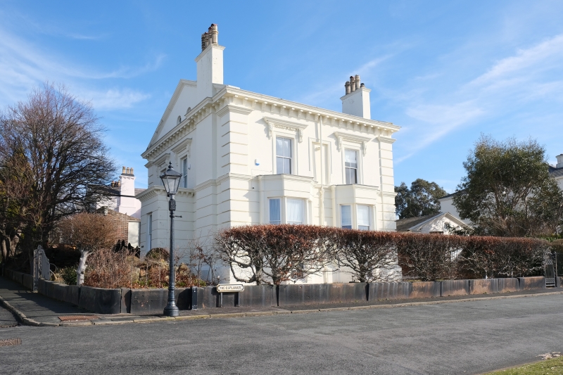
House. 1840's. Stucco with slate roof. 2 storeys, basement and attic, 3 x 2 bays. Ground floor has channelled rustication with cornice over; top frieze and cornice; quoin strips. 3rd bay end stack. 1st bay ground floor tripartite sash with angle pilasters and dentilled cornice. 1st floor windows have architraves, scrolly friezes and consoled dentilled cornices,that to 1st bay with balustraded balcony. Round-headed windows in pedimented gable. Entrance in porch with balustrade. Right return to the Esplanade has ground floor canted bay windows with Doric colonnettes, that to 2nd bay with balustrade. Some iron railings, and iron gate piers.
Listing NGR: SJ3884784768
External links are from the relevant listing authority and, where applicable, Wikidata. Wikidata IDs may be related buildings as well as this specific building. If you want to add or update a link, you will need to do so by editing the Wikidata entry.


Other nearby listed buildings