Latitude: 54.6639 / 54°39'50"N
Longitude: -3.3621 / 3°21'43"W
OS Eastings: 312236
OS Northings: 530721
OS Grid: NY122307
Mapcode National: GBR 4GYH.XX
Mapcode Global: WH6ZX.B17D
Plus Code: 9C6RMJ7Q+H4
Entry Name: Cocker Bridge
Listing Date: 26 July 1974
Grade: II
Source: Historic England
Source ID: 1067800
English Heritage Legacy ID: 71649
ID on this website: 101067800
Location: Cockermouth, Cumberland, Cumbria, CA13
County: Cumberland
District: Allerdale
Civil Parish: Cockermouth
Built-Up Area: Cockermouth
Traditional County: Cumberland
Lieutenancy Area (Ceremonial County): Cumbria
Church of England Parish: Cockermouth Area Team
Church of England Diocese: Carlisle
Tagged with: Bridge
1.
5161 Cocker Bridge
NY 1230 1/2
II
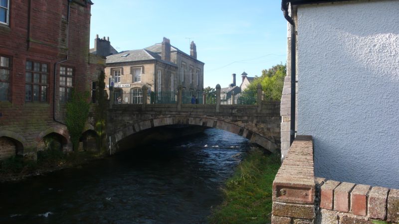
2. Rebuilt 1828. Spans River Cocker, near its junction with the Derwent, and carries the main street. Single segmental arch, 5 tall octagonal piers to iron railings on parapets.
Listing NGR: NY1223630721
External links are from the relevant listing authority and, where applicable, Wikidata. Wikidata IDs may be related buildings as well as this specific building. If you want to add or update a link, you will need to do so by editing the Wikidata entry.


Other nearby listed buildings