Latitude: 51.2705 / 51°16'13"N
Longitude: 1.1855 / 1°11'7"E
OS Eastings: 622297
OS Northings: 157191
OS Grid: TR222571
Mapcode National: GBR VZR.6JY
Mapcode Global: VHLGP.HBKD
Plus Code: 9F3375CP+55
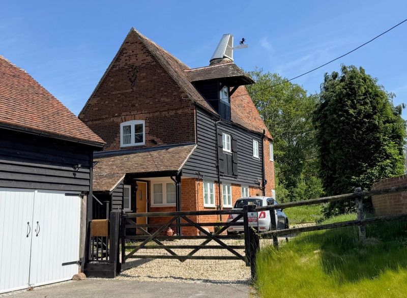
Entry Name: Cherville Oast
Listing Date: 1 October 1975
Grade: II
Source: Historic England
Source ID: 1067684
English Heritage Legacy ID: 171224
ID on this website: 101067684
Location: Bramling, Canterbury, Kent, CT3
County: Kent
District: Canterbury
Civil Parish: Ickham and Well
Traditional County: Kent
Lieutenancy Area (Ceremonial County): Kent
Tagged with: Building
1. 5273 ICKHAM AND WELL CHERVILLE LANE
Cherville Oast TR 25 NW 10/400 1.10.15
II
2. C18. Outbuilding of 2 storeys. Weatherboarded with tiled roof, hipped lucam and loading doors. Two casements. Attached to the south-east are the remains of a semi-circular brick oast. One storey weathboarded extension to north-west.
Listing NGR: TR2229757191
External links are from the relevant listing authority and, where applicable, Wikidata. Wikidata IDs may be related buildings as well as this specific building. If you want to add or update a link, you will need to do so by editing the Wikidata entry.


Other nearby listed buildings