Latitude: 53.4708 / 53°28'14"N
Longitude: -2.3872 / 2°23'13"W
OS Eastings: 374396
OS Northings: 397190
OS Grid: SJ743971
Mapcode National: GBR CXR9.ZJ
Mapcode Global: WH98G.91H0
Plus Code: 9C5VFJC7+84
Entry Name: Control Tower at Barton Aerodrome
Listing Date: 16 July 1987
Grade: II
Source: Historic England
Source ID: 1067500
English Heritage Legacy ID: 211941
ID on this website: 101067500
Location: Salford, Greater Manchester, M30
County: Salford
Electoral Ward/Division: Irlam
Parish: Non Civil Parish
Traditional County: Lancashire
Lieutenancy Area (Ceremonial County): Greater Manchester
Church of England Parish: Irlam St John the Baptist
Church of England Diocese: Manchester
Tagged with: Building
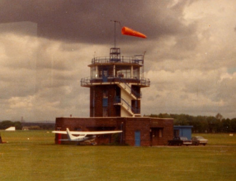
ECCLES LIVERPOOL ROAD SJ 79 NW (north side) 3/8 Control Tower at Barton Aerodrome - II Air traffic control tower. c.1937. Brick with reinforced concrete roofs. 3-stage octagonal tower rises from a single-storey podium with small radiating wings at 4 corners. The podium has a coped parapet above a soldier course and various doors and windows with glazing bars. The tower has a glazed upper stage with concrete balcony and steel railings. Access is gained by an external reinforced concrete dogleg stair. Barton was the first municipal airport in the world when it opened in 1930. The control tower was reported in the press in 1937 as "the first air traffic control station".
Listing NGR: SJ7439697190
External links are from the relevant listing authority and, where applicable, Wikidata. Wikidata IDs may be related buildings as well as this specific building. If you want to add or update a link, you will need to do so by editing the Wikidata entry.


Other nearby listed buildings