Latitude: 51.5091 / 51°30'32"N
Longitude: -0.1318 / 0°7'54"W
OS Eastings: 529744
OS Northings: 180564
OS Grid: TQ297805
Mapcode National: GBR GF.K6
Mapcode Global: VHGQZ.NBNG
Plus Code: 9C3XGV59+J7
Entry Name: Burberry's
Listing Date: 1 December 1987
Grade: II
Source: Historic England
Source ID: 1066642
English Heritage Legacy ID: 210133
ID on this website: 101066642
Location: London, Westminster, London, SW1Y
County: London
District: City of Westminster
Electoral Ward/Division: St James's
Parish: Non Civil Parish
Built-Up Area: City of Westminster
Traditional County: Middlesex
Lieutenancy Area (Ceremonial County): Greater London
Church of England Parish: St Martin-in-the-Fields
Church of England Diocese: London
Tagged with: Building
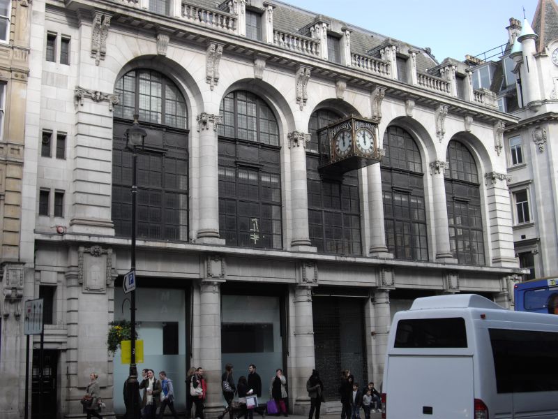
TQ 2980 NE CITY OF WESTMINSTER HAYMARKET, SW1 71/95 Nos. 18 to 22 consec. GV (Burberry's) II Grand retail premises. 1912 by Walter Cave. Stone faced corner block with slate roof. Edwardian neo Mannerism detail but restrained by Beaux Arts balance of composition. 3 storeys and slate mansard. 5 windows wide with narrow staircase bay to left and return to Orange Street. Ground floor display windows (unaltered) and central entrance with double doors articulated by a mannerist order of Doric engaged columns supporting entablature. 1st and 2nd floors have giant order of French Ionic columns creating grand arcade with the 2nd floor windows as lunettes in the clean cut ashlar of the arches. Banded pilasters each end of the elevation. Modillion cornice with balustrade between enriched dormers. Ornate bracketed clock at 2nd floor level. Similar details to Orange Street return.
Listing NGR: TQ2974480564
External links are from the relevant listing authority and, where applicable, Wikidata. Wikidata IDs may be related buildings as well as this specific building. If you want to add or update a link, you will need to do so by editing the Wikidata entry.


Other nearby listed buildings