Latitude: 51.4997 / 51°29'58"N
Longitude: -0.1405 / 0°8'25"W
OS Eastings: 529170
OS Northings: 179501
OS Grid: TQ291795
Mapcode National: GBR DJ.MK
Mapcode Global: VHGQZ.JK3P
Plus Code: 9C3XFVX5+VR
Entry Name: 16, Buckingham Gate SW1
Listing Date: 24 February 1958
Grade: II*
Source: Historic England
Source ID: 1066360
English Heritage Legacy ID: 208893
ID on this website: 101066360
Location: Belgravia, Westminster, London, SW1E
County: London
District: City of Westminster
Electoral Ward/Division: St James's
Parish: Non Civil Parish
Built-Up Area: City of Westminster
Traditional County: Middlesex
Lieutenancy Area (Ceremonial County): Greater London
Church of England Parish: St Peter Eaton Square
Church of England Diocese: London
Tagged with: Townhouse
TQ 2979 NW and SW CITY OF WESTMINSTER BUCKINGHAM GATE, SW1 90/39 ;99/17 24.2.58 No. 16
G.V. II*
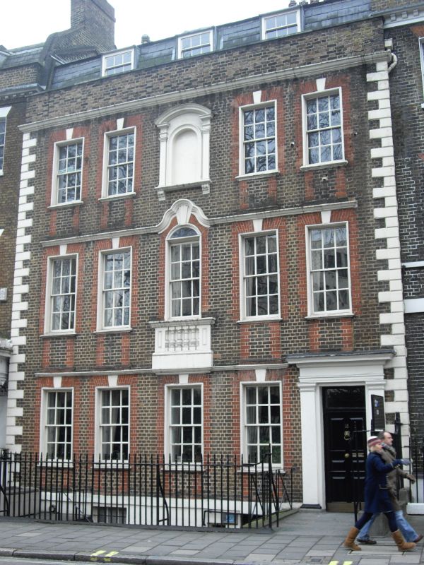
Terraced town house. 1706, attributed to Captain William Winde. Brown brick with rusticated stone flanks and stone dressings, slate roof. 3 storeys, basement and dormered mansard. 5 narrow windows wide. Doorway to right with panelled door in wooden doorcase of Doric pilasters and entablature. Recessed glazing bar sashes under flat gauged red brick arches with stone keys, moulded sills with raised brick aprons below. Central 1st floor window has semicircular arched head and blind balustrade below sill; the central 2nd floor bay with a stone niche with segmental open pediment in place of window. Thin stone cornice-bands above window heads and stone cornice below parapet with coping. Wrought iron area railings. Interior not inspected.
Listing NGR: TQ2915879483
External links are from the relevant listing authority and, where applicable, Wikidata. Wikidata IDs may be related buildings as well as this specific building. If you want to add or update a link, you will need to do so by editing the Wikidata entry.


Other nearby listed buildings