Latitude: 53.0236 / 53°1'25"N
Longitude: -2.6009 / 2°36'3"W
OS Eastings: 359793
OS Northings: 347539
OS Grid: SJ597475
Mapcode National: GBR 7P.FJRX
Mapcode Global: WH9BH.08SC
Plus Code: 9C5V29FX+FM
Entry Name: School
Listing Date: 19 May 1986
Grade: II
Source: Historic England
Source ID: 1066020
English Heritage Legacy ID: 422444
Also known as: Wrenbury School
Wrenbury Primary School
ID on this website: 101066020
Location: Wrenbury-cum-Frith, Cheshire East, Cheshire, CW5
County: Cheshire East
Civil Parish: Wrenbury cum Frith
Built-Up Area: Wrenbury-cum-Frith
Traditional County: Cheshire
Lieutenancy Area (Ceremonial County): Cheshire
Church of England Parish: Wrenbury St Margaret
Church of England Diocese: Chester
Tagged with: Building School building
WRENBURY CUM FRITH C.P. NANTWICH ROAD SJ 54 NE 2/84 School - - II
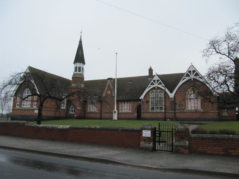
School. Dated 1879. Red English garden wall bond brick. L-shaped plan. Single storey. The road front has a projecting wing to the left hand side with a triple window of arched lights, alternating red and blue voussoirs and bands to either side. Timber work to the gable. To the right of this in the re-entrant angle is a square turret dying via offsets to a circular body with louvred bellcote and conical cap of shingles and lead with a weather vane to the apex. To the right again is a three-light window with ashlar surround and at right of this a projecting chimney breast with ashlar offsets and a circular date stone and blue brick diapering. To the right of this is an ashlar surrounded 3-light mullioned window. To the far right are two large triple windows with arched heads having gables above with decorative timber work.
Listing NGR: SJ5979347539
External links are from the relevant listing authority and, where applicable, Wikidata. Wikidata IDs may be related buildings as well as this specific building. If you want to add or update a link, you will need to do so by editing the Wikidata entry.


Other nearby listed buildings