Latitude: 51.5188 / 51°31'7"N
Longitude: -0.0434 / 0°2'36"W
OS Eastings: 535850
OS Northings: 181799
OS Grid: TQ358817
Mapcode National: GBR J9.5Q0
Mapcode Global: VHGR1.63D1
Plus Code: 9C3XGX94+GJ
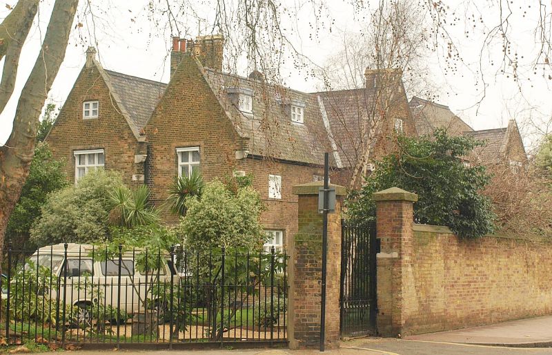
Entry Name: St Dunstan's Rectory
Listing Date: 27 September 1973
Grade: II
Source: Historic England
Source ID: 1065819
English Heritage Legacy ID: 206352
ID on this website: 101065819
Location: Stepney, Tower Hamlets, London, E1
County: London
District: Tower Hamlets
Electoral Ward/Division: St Dunstan's
Parish: Non Civil Parish
Built-Up Area: Tower Hamlets
Traditional County: Middlesex
Lieutenancy Area (Ceremonial County): Greater London
Church of England Parish: St Dunstan Stepney
Church of England Diocese: London
Tagged with: Building
WHITE HORSE LANE E1 1. 4431 (West Side) St Dunstan's Rectory TQ 3581 16/595 II GV 2. Mid/later C19. Stock brick, gabled with stone coped eaves, kneelers and slate roof. 2 storeys, 2 windows to Rectory Square with transoms and mullions. Irregular plan.
St Dunstan's Rectory and garden wall and gate piers form a group with the East London Synagogue, Stepney Green, and its walls and gate piers (see also Rectory Square).
Listing NGR: TQ3585081799
External links are from the relevant listing authority and, where applicable, Wikidata. Wikidata IDs may be related buildings as well as this specific building. If you want to add or update a link, you will need to do so by editing the Wikidata entry.


Other nearby listed buildings