Latitude: 51.3677 / 51°22'3"N
Longitude: -0.157 / 0°9'25"W
OS Eastings: 528395
OS Northings: 164789
OS Grid: TQ283647
Mapcode National: GBR F7.M3H
Mapcode Global: VHGRK.7WCF
Plus Code: 9C3X9R9V+36
Entry Name: Parkfields
Listing Date: 1 March 1974
Grade: II
Source: Historic England
Source ID: 1065642
English Heritage Legacy ID: 206823
ID on this website: 101065642
Location: Carshalton, Sutton, London, SM5
County: London
District: Sutton
Electoral Ward/Division: Wallington North
Parish: Non Civil Parish
Built-Up Area: Sutton
Traditional County: Surrey
Lieutenancy Area (Ceremonial County): Greater London
Church of England Parish: Carshalton All Saints
Church of England Diocese: Southwark
Tagged with: Building
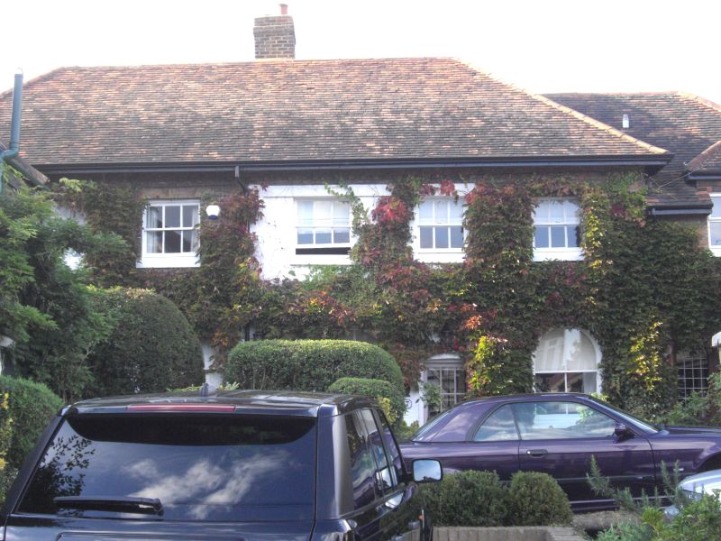
WESTCROFT ROAD 1. 4430 (North-West Side) CARSHALTON No 37 (Parkfields) TQ 2864 NW 21/203 II GV 2. Late C17 to C18. Formerly an ancillary building to an C18 house, Parkfields, which was demolished in early C20. 2 storeys. Hipped red tile roof. Brick with brick dentil eaves. Altered fenestration. 6 windows to 1st floor, 5 sash windows and a 3-light casement with iron tracery. On ground floor, round-headed arches, some of them now converted to windows. From left to right on ground floor, 2 windows, door, window and single storey addition at right hand end with modern glazed door. Band.
Parkfields, piers, walls and railings to Parkfields, Westcroft Cottage and Westcroft Farm Cottage form a group with Bramblehaw End, Bramblehaw Cottage and outbuilding over drive to Bramblehaw Cottage.
Listing NGR: TQ2839564789
External links are from the relevant listing authority and, where applicable, Wikidata. Wikidata IDs may be related buildings as well as this specific building. If you want to add or update a link, you will need to do so by editing the Wikidata entry.


Other nearby listed buildings