Latitude: 51.5123 / 51°30'44"N
Longitude: -0.0291 / 0°1'44"W
OS Eastings: 536863
OS Northings: 181109
OS Grid: TQ368811
Mapcode National: GBR K4.HB2
Mapcode Global: VHGR1.F7ZZ
Plus Code: 9C3XGX6C+W9
Entry Name: 799, Commercial Road E14
Listing Date: 27 September 1973
Grade: II
Source: Historic England
Source ID: 1065239
English Heritage Legacy ID: 205898
ID on this website: 101065239
Location: Coalmakers Wharf, Tower Hamlets, London, E14
County: London
District: Tower Hamlets
Electoral Ward/Division: Mile End
Parish: Non Civil Parish
Built-Up Area: Tower Hamlets
Traditional County: Middlesex
Lieutenancy Area (Ceremonial County): Greater London
Church of England Parish: St Anne Limehouse
Church of England Diocese: London
Tagged with: Building
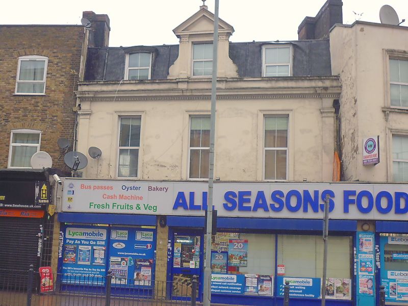
COMMERCIAL ROAD E14 1. 4431 (North Side) No 799 TQ 3681 17/629 II GV 2. Early C18. Rendered facade with heavy eaves cornice and blocking course. Mansard slate roof. Flanking pilasters to 1st floor. 2 storeys and dormers, centre with pediment, outer dormers segmental heads. 3 windows, those of 1st floor with stucco architraves. Later shop front advanced over No 801.
Nos 795 to 805 (odd) and the Star of the East Public House form a group with the lamp standards in front of the Star of the East Public House.
Listing NGR: TQ3686681108
External links are from the relevant listing authority and, where applicable, Wikidata. Wikidata IDs may be related buildings as well as this specific building. If you want to add or update a link, you will need to do so by editing the Wikidata entry.


Other nearby listed buildings