Latitude: 54.2367 / 54°14'12"N
Longitude: -0.7185 / 0°43'6"W
OS Eastings: 483620
OS Northings: 483089
OS Grid: SE836830
Mapcode National: GBR RMFG.70
Mapcode Global: WHF9X.YR0Y
Plus Code: 9C6X67PJ+MH
Entry Name: Thornton Bridge
Listing Date: 5 February 1986
Grade: II
Source: Historic England
Source ID: 1064787
English Heritage Legacy ID: 439919
ID on this website: 101064787
Location: Thornton-le-Dale, North Yorkshire, YO18
County: North Yorkshire
District: Ryedale
Civil Parish: Thornton-le-Dale
Built-Up Area: Thornton-le-Dale
Traditional County: Yorkshire
Lieutenancy Area (Ceremonial County): North Yorkshire
Tagged with: Bridge
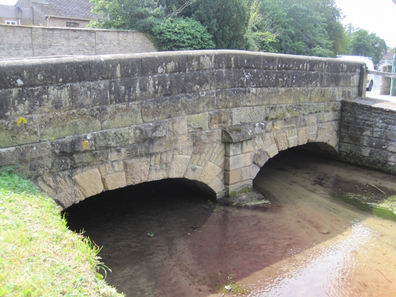
NORTH YORKSHIRE RYEDALE DISTRICT COUNCIL 5340 THORNTON DALE A 170 SE 8383 14/82 Thornton Bridge GV II Bridge. Early - mid C18, widened and partly rebuilt mid C19. Dressed sandstone and limestone. 3 arches, one spanning the diverted millstream. Upstream side: 2 elliptical arches of alternately long and short chamfered voussoirs, separated by dwarf buttress pier. Semicircular millstream arch to right rebuilt. Downstream side: semicircular arches of rusticated voussoirs. Plain parapet to both sides with cambered coping and cylindrical, domed piers at each end.
Listing NGR: SE8362083089
External links are from the relevant listing authority and, where applicable, Wikidata. Wikidata IDs may be related buildings as well as this specific building. If you want to add or update a link, you will need to do so by editing the Wikidata entry.


Other nearby listed buildings