Latitude: 53.3867 / 53°23'12"N
Longitude: -2.949 / 2°56'56"W
OS Eastings: 336981
OS Northings: 388179
OS Grid: SJ369881
Mapcode National: GBR 7DW.2Y
Mapcode Global: WH87F.N4YJ
Plus Code: 9C5V93P2+MC
Entry Name: Bellerive Building
Listing Date: 14 March 1975
Last Amended: 19 June 1985
Grade: II
Source: Historic England
Source ID: 1063786
English Heritage Legacy ID: 359749
ID on this website: 101063786
Location: Princes Park, Liverpool, Merseyside, L8
County: Liverpool
Electoral Ward/Division: Princes Park
Parish: Non Civil Parish
Built-Up Area: Liverpool
Traditional County: Lancashire
Lieutenancy Area (Ceremonial County): Merseyside
Church of England Parish: Toxteth Park Christ Church
Church of England Diocese: Liverpool
Tagged with: Building
SJ 3688 WINDERMERE TERRACE (South side) L8
32/1366 Bellerive Building (formerly listed as Bellerive Convent on Ullet Road) 14.3.75. G.V. II
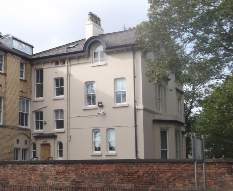
House. 1860s. Stucco with slate roof. 2 storeys, 3 bays. 1st bay recessed, 2nd bay projecting tower with pyramidal roof, 3rd bay breaks forward under gable with 2-storey canted bay with hipped roof. 1st floor sill band and boxed eaves on brackets. Varied fenestration with architraves, mostly round heads. Canted bay has 1st floor blind windows, the central one with pediment. 1st-bay porch has round-headed entrance, panelled frieze and cornice, balustraded parapet with statue of Jesus. Window above round-headed with hood projecting above eaves. Interior has hall with modillioned cornice and doors with architraves, foliated friezes and cornices.
Listing NGR: SJ3698188179
External links are from the relevant listing authority and, where applicable, Wikidata. Wikidata IDs may be related buildings as well as this specific building. If you want to add or update a link, you will need to do so by editing the Wikidata entry.


Other nearby listed buildings