Latitude: 53.3922 / 53°23'31"N
Longitude: 0.1783 / 0°10'41"E
OS Eastings: 544948
OS Northings: 390582
OS Grid: TF449905
Mapcode National: GBR YYP6.DQ
Mapcode Global: WHJKT.QZ3W
Plus Code: 9F5295RH+V8
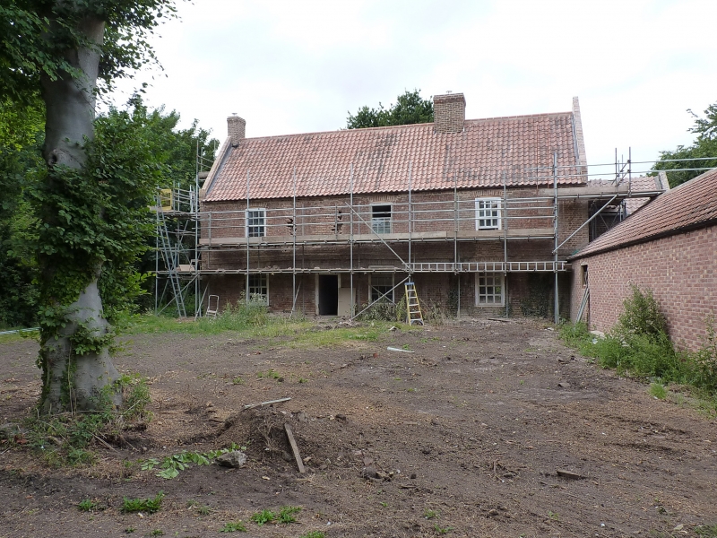
Entry Name: Moat Hall
Listing Date: 9 March 1967
Last Amended: 17 November 1986
Grade: II
Source: Historic England
Source ID: 1063057
English Heritage Legacy ID: 195493
ID on this website: 101063057
Location: Saltfleetby All Saints, East Lindsey, Lincolnshire, LN11
County: Lincolnshire
District: East Lindsey
Civil Parish: Saltfleetby
Traditional County: Lincolnshire
Lieutenancy Area (Ceremonial County): Lincolnshire
Church of England Parish: Saltfleetby St Peter
Church of England Diocese: Lincoln
Tagged with: Building
SALTFLEETBY ALL SAINTS MANBY ROAD TF 49 SW (north side) 5/51 Moat Hall (formerly listed as Saltfleetby 9.3.67 Hall) GV II
Farmhouse. Early C18. Red brick. Pantile roof with brick coped and tumbled gables and single gable stack and single ridge stack. 2 storeys and garret, 4 bay front with plinth and first floor band. Doorway to left with glazed C20 door. 2 glazing bar sashes to right; single glazing bar sash to left. 2 glazing bar sashes with segmenal heads to right with blind panel with segmental head beyond. Blocked opening to left with glazing bar sash with segmental head beyond to left. Dining room with chamfered beam with stops. Early C18 roof intact. Moated site.
Listing NGR: TF4494890582
External links are from the relevant listing authority and, where applicable, Wikidata. Wikidata IDs may be related buildings as well as this specific building. If you want to add or update a link, you will need to do so by editing the Wikidata entry.


Other nearby listed buildings