Latitude: 52.9121 / 52°54'43"N
Longitude: -0.6436 / 0°38'36"W
OS Eastings: 491312
OS Northings: 335830
OS Grid: SK913358
Mapcode National: GBR DQ4.D3H
Mapcode Global: WHGKP.22T9
Plus Code: 9C4XW964+VH
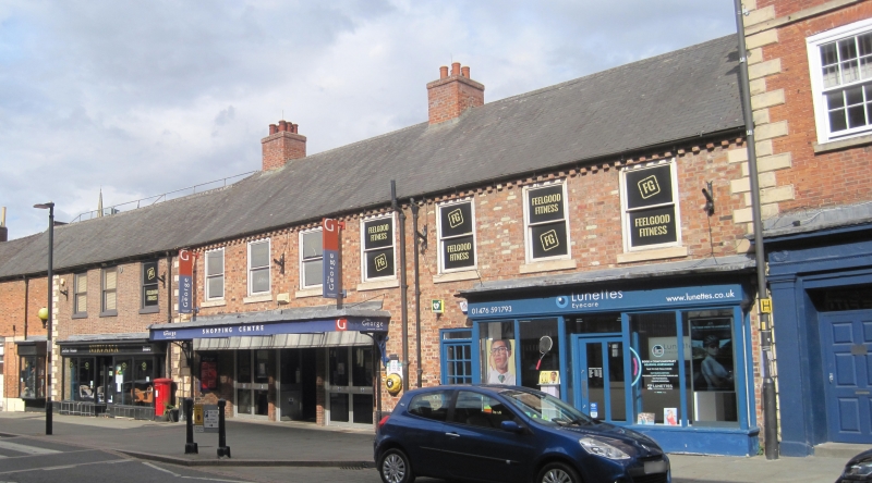
Entry Name: 4, 4A, 5 and 6, Westgate
Listing Date: 20 April 1972
Grade: II
Source: Historic England
Source ID: 1062441
English Heritage Legacy ID: 193046
ID on this website: 101062441
Location: Grantham, South Kesteven, Lincolnshire, NG31
County: Lincolnshire
District: South Kesteven
Electoral Ward/Division: Grantham St Wulfram's
Parish: Grantham
Built-Up Area: Grantham
Traditional County: Lincolnshire
Lieutenancy Area (Ceremonial County): Lincolnshire
Church of England Parish: Grantham St Wulfram
Church of England Diocese: Lincoln
Tagged with: Building
WESTGATE 1. 1146 (East Side) Nos.4 and 4A SK 9135 NW 8/130 Nos. 5 and 6 II GV 2. Late C18, 2-storey, red brick, slate roof, painted rusticated quoins; each with 3 windows, flush frames; glazing bars to No. 6 only; modern shop fronts below.
Westgate Hall and Nos. I to 13 (consec) form a group.
Listing NGR: SK9131235830
External links are from the relevant listing authority and, where applicable, Wikidata. Wikidata IDs may be related buildings as well as this specific building. If you want to add or update a link, you will need to do so by editing the Wikidata entry.


Other nearby listed buildings