Latitude: 51.08 / 51°4'47"N
Longitude: 1.1835 / 1°11'0"E
OS Eastings: 623077
OS Northings: 136003
OS Grid: TR230360
Mapcode National: GBR W22.617
Mapcode Global: FRA F6C8.GWP
Plus Code: 9F3335HM+X9
Entry Name: The Guildhall
Listing Date: 11 March 1975
Grade: II
Source: Historic England
Source ID: 1061233
English Heritage Legacy ID: 175273
ID on this website: 101061233
Location: Folkestone, Folkestone and Hythe, Kent, CT20
County: Kent
District: Folkestone and Hythe
Civil Parish: Folkestone
Built-Up Area: Folkestone
Traditional County: Kent
Lieutenancy Area (Ceremonial County): Kent
Tagged with: Inn
This list entry was subject to a Minor Amendment on 15 May 2025 to amend the name and address and reformat the text to current standards
TR 2335 NW 2/53
TR 2336 SW 3/53
FOLKESTONE
THE BAYLE (south east side)
No. 42, The Guildhall
(Formerly listed as The Globe Inn, THE BAYLE)
GV
II
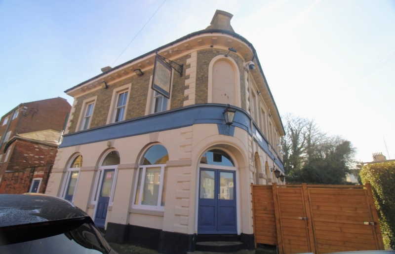
Mid C19. Two storeys white brick, the ground floor colourwashed. Tiled roof with modillion cornice. Long and short quoins. The front elevation has five sashes set in moulded architraves with verticals only. The corner has one round-headed blank. Tile elevation to the Parade has three sashes set in moulded architraves with verticals only. The ground floor has round-headed windows set in arcading with keystone above. Round-headed doorcase in the corner surmounted by vitruvian scroll frieze.
Nos 26 to 40 (even) form a group with The Battery, Statue in grounds of The Battery and
The Guildhall.
Listing NGR: TR2307736003
External links are from the relevant listing authority and, where applicable, Wikidata. Wikidata IDs may be related buildings as well as this specific building. If you want to add or update a link, you will need to do so by editing the Wikidata entry.


Other nearby listed buildings