Latitude: 51.0734 / 51°4'24"N
Longitude: 1.1424 / 1°8'32"E
OS Eastings: 620230
OS Northings: 135151
OS Grid: TR202351
Mapcode National: GBR V0P.MN0
Mapcode Global: FRA F688.YPL
Plus Code: 9F3334FR+9X
Entry Name: 118, High Street
Listing Date: 11 March 1975
Grade: II
Source: Historic England
Source ID: 1061192
English Heritage Legacy ID: 175374
ID on this website: 101061192
Location: Sandgate, Folkestone and Hythe, Kent, CT20
County: Kent
District: Folkestone and Hythe
Civil Parish: Sandgate
Built-Up Area: Folkestone
Traditional County: Kent
Lieutenancy Area (Ceremonial County): Kent
Tagged with: Building
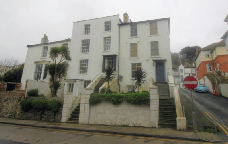
1. 5281 HIGH STREET (North West Side) SANDGATE No 118 TR 2035 SW 8/186 II GV 2. Early C19. 3 storeys and semi-basement painted brick. Hipped old tiled roof. 2 sashes with glazing bars intact. Right side doorcase with flat hood, dentil cornice, pilasters, panelled reveals, fanlight and 6 panelled door, approached up a flight of stone steps. The side elevation is weatherboarded.
Nos 118 to 122 (even) form a group.
Listing NGR: TR2023035151
External links are from the relevant listing authority and, where applicable, Wikidata. Wikidata IDs may be related buildings as well as this specific building. If you want to add or update a link, you will need to do so by editing the Wikidata entry.


Other nearby listed buildings