Latitude: 51.0242 / 51°1'27"N
Longitude: 0.9955 / 0°59'43"E
OS Eastings: 610164
OS Northings: 129252
OS Grid: TR101292
Mapcode National: GBR SZR.LJ3
Mapcode Global: FRA D6ZD.TXK
Plus Code: 9F322XFW+M5
Entry Name: Martello Tower No 24
Listing Date: 23 April 1985
Grade: II
Source: Historic England
Source ID: 1061124
English Heritage Legacy ID: 175512
ID on this website: 101061124
Location: Dymchurch, Folkestone and Hythe, Kent, TN29
County: Kent
District: Folkestone and Hythe
Civil Parish: Dymchurch
Built-Up Area: Dymchurch
Traditional County: Kent
Lieutenancy Area (Ceremonial County): Kent
TR 101 292 DYMCHURCH HIGH STREET (A259) (east side)
4/54 Martello Tower No.24
II
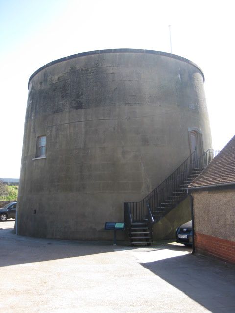
Martello Tower. 1806. Brick, covered in channelled cement render. Circular, slightly tapering tower about 30 feet high. Walls said to be 5½-6 feet thick. Shallow domed roof surrounded by projecting cement-rendered coping. 2 small horned recessed glazing bar sashes, one to north and one to south with cills about 12 feet up. 2 small ventilation grilles towards base. Vertical door with proud architrave and segmental head, with cill about 10 feet up, on west side. T-shaped recess below cill with surround continued from door architrave. Flagpole and gun mounted on done. No.24 on plaque over doorway. Now reached by external C20 metal staircase. Interior: not inspected, but said to contain central brick pillar with vaulted arches, magazine on ground floor and 2 rooms as quarters for garrison on first floor. One of a series built in 1806 as gunposts against a possible Napoleonic invasion. Stands immediately behind sea wall. Scheduled Ancient Monument. See also High Street (east side) Martello Tower No.25 and Hythe Road (east side) Martello Tower No.23. __ _____
Listing NGR: TR1016429252


Other nearby listed buildings