Latitude: 51.2134 / 51°12'48"N
Longitude: 0.5939 / 0°35'38"E
OS Eastings: 581267
OS Northings: 149218
OS Grid: TQ812492
Mapcode National: GBR QT7.T5N
Mapcode Global: VHJMN.7RVP
Plus Code: 9F326H7V+9H
Entry Name: Former Almshouses, Now Part of Sutton Valence School
Listing Date: 20 October 1952
Grade: II
Source: Historic England
Source ID: 1060910
English Heritage Legacy ID: 174158
ID on this website: 101060910
Location: Sutton Valence, Maidstone, Kent, ME17
County: Kent
District: Maidstone
Civil Parish: Sutton Valence
Built-Up Area: Sutton Valence
Traditional County: Kent
Lieutenancy Area (Ceremonial County): Kent
Tagged with: Almshouse
SUTTON VALENCE HIGH STREET TQ 8049-8149 (north side) 7/138 Former Almshouses, now 20.10.52 part of Sutton Valence School II
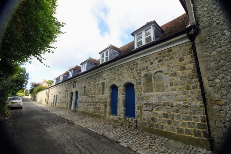
Row of 6 almshouses, now part of school. Founded 1574 by William Lambe, restored after fire 1909-1910. Small blocks of coursed stone, with plain tile roof. One storey and attic on moulded plinth. Moulded wooden eaves cornice. 6 hipped dormers Regular 6-window front of 2-light chamfered stone mullion windows with 4-centred arched lights, one window flanking each pair of doors with interval between each group. Six chamfered 4-centred arched stone doorways in pairs; 2 towards each end and 2 to centre. Ribbed doors. Coat of arms with achievements set towards centre. Interiors not inspected.
Listing NGR: TQ8126749218
External links are from the relevant listing authority and, where applicable, Wikidata. Wikidata IDs may be related buildings as well as this specific building. If you want to add or update a link, you will need to do so by editing the Wikidata entry.


Other nearby listed buildings