Latitude: 51.2737 / 51°16'25"N
Longitude: 0.6562 / 0°39'22"E
OS Eastings: 585372
OS Northings: 156074
OS Grid: TQ853560
Mapcode National: GBR QSQ.4QD
Mapcode Global: VHJMH.B78Y
Plus Code: 9F327MF4+FF
Entry Name: Gazebo About 100 Metres North West of Hollingbourne House
Listing Date: 21 October 1987
Grade: II
Source: Historic England
Source ID: 1060799
English Heritage Legacy ID: 174391
ID on this website: 101060799
Location: Maidstone, Kent, ME17
County: Kent
District: Maidstone
Civil Parish: Hollingbourne
Traditional County: Kent
Lieutenancy Area (Ceremonial County): Kent
Tagged with: Gazebo
HOLLINGBOURNE THE HILL TQ 85 NE (East Side)
2/163 Gazebo about 100 metres north- west of Hollingbourne House.
II
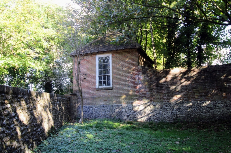
Gazebo. Late C18. Red brick in Flemish bond. Plain tile roof. Rectangular plan. Chamfered brick plinth, on flint base with stone quoins. Pyramidal roof. Rectangular window to south with Gothick panes. Blocked windows to west and north. Interior not inspected.
Listing NGR: TQ8545755990
External links are from the relevant listing authority and, where applicable, Wikidata. Wikidata IDs may be related buildings as well as this specific building. If you want to add or update a link, you will need to do so by editing the Wikidata entry.


Other nearby listed buildings