Latitude: 51.2613 / 51°15'40"N
Longitude: 0.6278 / 0°37'40"E
OS Eastings: 583443
OS Northings: 154632
OS Grid: TQ834546
Mapcode National: GBR QSP.X4B
Mapcode Global: VHJMG.TKSF
Plus Code: 9F327J6H+G4
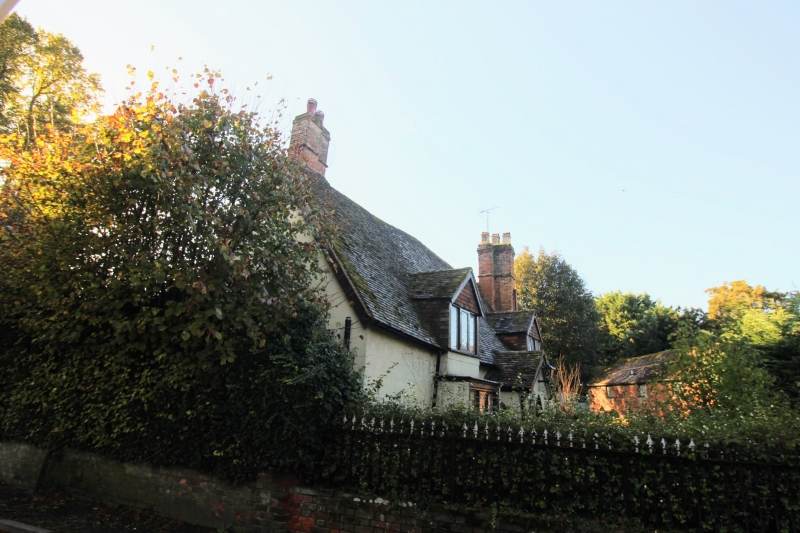
Entry Name: Tanyard House
Listing Date: 26 April 1968
Grade: II
Source: Historic England
Source ID: 1060797
English Heritage Legacy ID: 174383
ID on this website: 101060797
Location: Eyhorne Street, Maidstone, Kent, ME17
County: Kent
District: Maidstone
Civil Parish: Hollingbourne
Traditional County: Kent
Lieutenancy Area (Ceremonial County): Kent
Tagged with: House
HOLLINGBOURNE EYHORNE STREET TQ 8354 (South Side)
9/155 Tanyard House 26.4.68
GV II
House. Possibly C17 or C18. Pebbledashed. Plain tilt roof. Single storey and attic on pebbledashed plinth. Brick stack in front slope of roof to right end. Irregular fenestration of two 3-light dormers above rectangular ground-floor bay windows. Boarded door in central gabled porch. Rear return wing to right. Interior not inspected.
Listing NGR: TQ8344354632
External links are from the relevant listing authority and, where applicable, Wikidata. Wikidata IDs may be related buildings as well as this specific building. If you want to add or update a link, you will need to do so by editing the Wikidata entry.


Other nearby listed buildings