Latitude: 51.1735 / 51°10'24"N
Longitude: 0.4973 / 0°29'50"E
OS Eastings: 574672
OS Northings: 144544
OS Grid: TQ746445
Mapcode National: GBR PSC.6LH
Mapcode Global: VHJMS.KRSS
Plus Code: 9F325FFW+9W
Entry Name: The Place
Listing Date: 23 May 1967
Last Amended: 23 March 1987
Grade: II
Source: Historic England
Source ID: 1060692
English Heritage Legacy ID: 174725
ID on this website: 101060692
Location: Marden, Maidstone, Kent, TN12
County: Kent
District: Maidstone
Civil Parish: Marden
Built-Up Area: Marden
Traditional County: Kent
Lieutenancy Area (Ceremonial County): Kent
Tagged with: Building
TQ 7444 MARDEN HIGH STREET (north-east side)
5/67 The Place (formerly 23.5.67 listed as The House attached to Hayes, Grocers,and Hayes Grocers.)
GV II
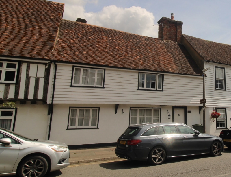
House pair, or house-and-shop pair, now restaurant. Left section C17, with later alterations, right section C18 or early C19. Timber framed. Ground floor clad with channelled render, first floor weatherboarded. Plain tile roof. Left section: 2 storeys, with continuous jetty. Gabled. Rear brick stack to left and multiple red and grey brick ridge stack to right. Irregular fenestration of two three-light casements. Half-glazed door under right stack. Right section: 2 taller storeys. Gabled. No visible stack. Regular two- window front of 12-pane sashes. Central half-glazed door. Interior not inspected. Formerly separate properties.
Listing NGR: TQ7467844536
External links are from the relevant listing authority and, where applicable, Wikidata. Wikidata IDs may be related buildings as well as this specific building. If you want to add or update a link, you will need to do so by editing the Wikidata entry.


Other nearby listed buildings