Latitude: 51.5862 / 51°35'10"N
Longitude: -1.2604 / 1°15'37"W
OS Eastings: 451336
OS Northings: 187742
OS Grid: SU513877
Mapcode National: GBR 912.D64
Mapcode Global: VHCYM.3DJC
Plus Code: 9C3WHPPQ+FR
Entry Name: Wycherts
Listing Date: 4 November 1986
Grade: II
Source: Historic England
Source ID: 1059806
English Heritage Legacy ID: 248766
ID on this website: 101059806
Location: West Hagbourne, South Oxfordshire, OX11
County: Oxfordshire
District: South Oxfordshire
Civil Parish: West Hagbourne
Traditional County: Berkshire
Lieutenancy Area (Ceremonial County): Oxfordshire
Church of England Parish: Hagbourne
Church of England Diocese: Oxford
Tagged with: Building
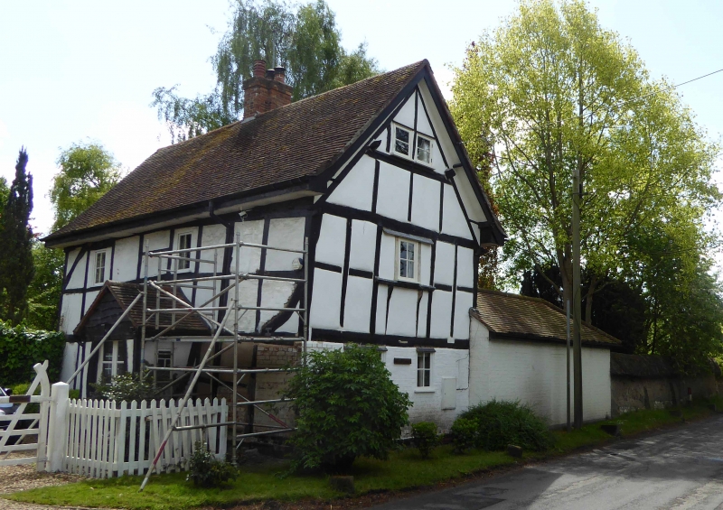
WEST HAGBOURNE MAIN STREET SU5187 (East side) 18/153 Wycherts GV II Shown on O.S. map as Mogg's Cottage. House. Late C17. Painted brick base; large timber-framing; rendered and brick infill; old plain-tile roof; brick ridge stack to centre. 2-unit lobby-entry plan. 2-storey, 2-window range at right-angles to street. Double glazed doors to C20 porch to centre. 2-light wood casement to right. 2 single-light casements to first floor. Queen-post roof truss to right return gable end. Interior not inspected.
Listing NGR: SU5133687742
External links are from the relevant listing authority and, where applicable, Wikidata. Wikidata IDs may be related buildings as well as this specific building. If you want to add or update a link, you will need to do so by editing the Wikidata entry.


Other nearby listed buildings