Latitude: 51.5132 / 51°30'47"N
Longitude: -0.9522 / 0°57'7"W
OS Eastings: 472807
OS Northings: 179882
OS Grid: SU728798
Mapcode National: GBR C53.02M
Mapcode Global: VHDWM.F7ZB
Plus Code: 9C3XG27X+74
Entry Name: Crowsley Park House
Listing Date: 24 October 1951
Last Amended: 13 February 1985
Grade: II
Source: Historic England
Source ID: 1059598
English Heritage Legacy ID: 247177
ID on this website: 101059598
Location: Crowsley, South Oxfordshire, RG9
County: Oxfordshire
District: South Oxfordshire
Civil Parish: Binfield Heath
Traditional County: Oxfordshire
Lieutenancy Area (Ceremonial County): Oxfordshire
Church of England Parish: Shiplake with Dunsden
Church of England Diocese: Oxford
Tagged with: English country house
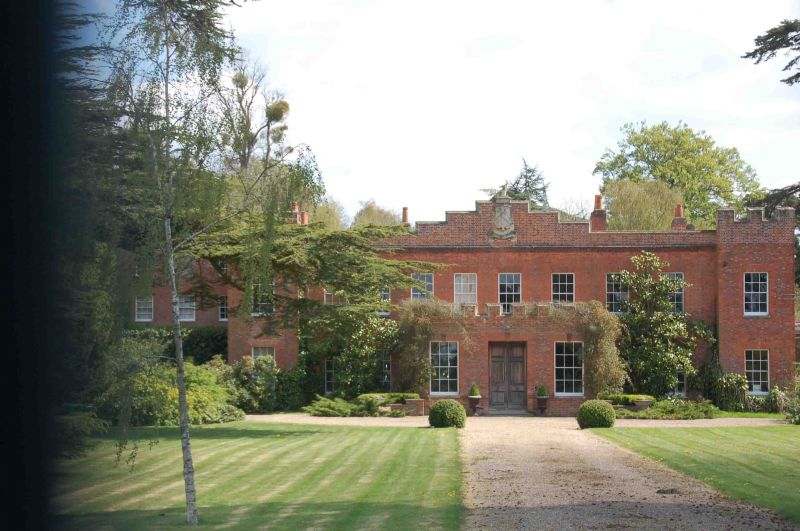
SHIPLAKE SU77NW 9/155 Crowsley Park House 24/10/51 (Formerly listed as Crowsley Park including Stable Block) GV II Country House. Probably early C18 with late C18 alterations. Red brick with flared leaders, plain tile roof, brick stacks. Double-depth plan. 2-storey, 10-window range, 1:8:1. Central projecting porch with panelled double door flanked by sashs crenellated parapet. 12-pane sashes to all openings. End bays to left and right project to form towers with crenellated parapets. Shallow stepped gable to centre with armorial shield to centre. Rear: 2- storey 13-window range, 3:1:2:1:2:1:3 has central sash door with carved stone hood on brackets, round-headed sash above. 12-pane sashes to all openings with segmental headed sashes to 3 bay ends. Interior: dog-leg stair case with barley-sugar twist baluster, richly carved spandels to the steps, which are cyma reversa shaped underneath.
Listing NGR: SU7280779882
External links are from the relevant listing authority and, where applicable, Wikidata. Wikidata IDs may be related buildings as well as this specific building. If you want to add or update a link, you will need to do so by editing the Wikidata entry.


Other nearby listed buildings