Latitude: 52.7065 / 52°42'23"N
Longitude: -2.758 / 2°45'28"W
OS Eastings: 348884
OS Northings: 312361
OS Grid: SJ488123
Mapcode National: GBR BJ.2FPT
Mapcode Global: WH8BT.L7WG
Plus Code: 9C4VP64R+HR
Entry Name: 16, St John's Hill
Listing Date: 10 January 1953
Grade: II
Source: Historic England
Source ID: 1058971
English Heritage Legacy ID: 458037
ID on this website: 101058971
Location: Shrewsbury, Shropshire, SY1
County: Shropshire
Civil Parish: Shrewsbury
Built-Up Area: Shrewsbury
Traditional County: Shropshire
Lieutenancy Area (Ceremonial County): Shropshire
Church of England Parish: Shrewsbury St Chad
Church of England Diocese: Lichfield
Tagged with: Building
SHREWSBURY
SJ4812SE ST JOHN'S HILL 653-1/14/557 (South East side) 10/01/53 No.16
GV II
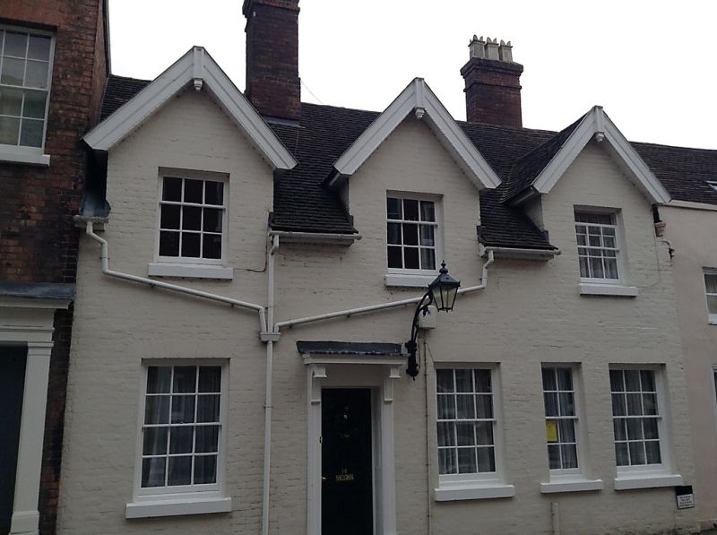
House. Largely early C17. Part of a formerly larger dwelling with hall and cross wing plan, with No.17 (qv), and subsequently altered. Painted brick with plain tiled roof. 2-storeyed, 3-window range with tall gabled dormers. Irregular fenestration to ground floor, with three 12-pane sashes beneath the gables, and an additional 4-pane sash window in the right-hand bay. 6-panelled door with architrave with panelled rebates and canopy carried on consoles to left of centre. Barge-boards to gables. 2 axial stacks. Some disturbance in brick work suggesting possible alteration/refronting.
Listing NGR: SJ4888412361
External links are from the relevant listing authority and, where applicable, Wikidata. Wikidata IDs may be related buildings as well as this specific building. If you want to add or update a link, you will need to do so by editing the Wikidata entry.


Other nearby listed buildings