Latitude: 51.1475 / 51°8'50"N
Longitude: -2.7123 / 2°42'44"W
OS Eastings: 350271
OS Northings: 138933
OS Grid: ST502389
Mapcode National: GBR MK.7YG3
Mapcode Global: VH8B3.XFZ5
Plus Code: 9C3V47WQ+X3
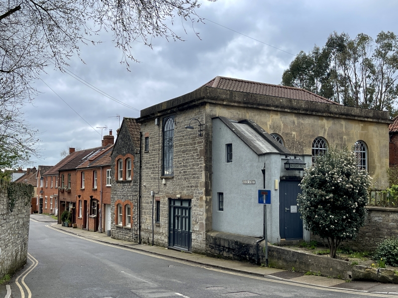
Entry Name: Avalon Hall
Listing Date: 15 March 1974
Grade: II
Source: Historic England
Source ID: 1057902
English Heritage Legacy ID: 265967
ID on this website: 101057902
Location: Glastonbury, Somerset, BA6
County: Somerset
District: Mendip
Civil Parish: Glastonbury
Built-Up Area: Glastonbury
Traditional County: Somerset
Lieutenancy Area (Ceremonial County): Somerset
Tagged with: Building
LAMBROOK STREET 1. 1133 (West Side) Avalon Hall ST 5038 8/68 II GV 2. On corner with Silver Street. Originally a Non-Conformist chapel and subsequently used as a parish room. Early C19. 1 storey. Rectangular stone building with ashlar face to Lambrook Street. Moulded cornice. Hipped pantile roof. 3 round-headed windows with Gothic glazing bars. Projecting covered stair to entrance at south end. The listed buildings on the West side form a group.
Listing NGR: ST5027138933
External links are from the relevant listing authority and, where applicable, Wikidata. Wikidata IDs may be related buildings as well as this specific building. If you want to add or update a link, you will need to do so by editing the Wikidata entry.


Other nearby listed buildings