Latitude: 50.9439 / 50°56'37"N
Longitude: -2.661 / 2°39'39"W
OS Eastings: 353659
OS Northings: 116254
OS Grid: ST536162
Mapcode National: GBR MM.NZLF
Mapcode Global: FRA 569M.551
Plus Code: 9C2VW8VQ+GJ
Entry Name: Abbey Farm House
Listing Date: 19 March 1951
Grade: I
Source: Historic England
Source ID: 1056512
English Heritage Legacy ID: 261406
ID on this website: 101056512
Location: Preston Plucknett, Somerset, BA20
County: Somerset
District: South Somerset
Civil Parish: Yeovil
Built-Up Area: Yeovil
Traditional County: Somerset
Lieutenancy Area (Ceremonial County): Somerset
Tagged with: Farmhouse
ST51NW YEOVIL CP PRESTON ROAD (North side)
1/68 Abbey Farm House
19.3.51
GV I
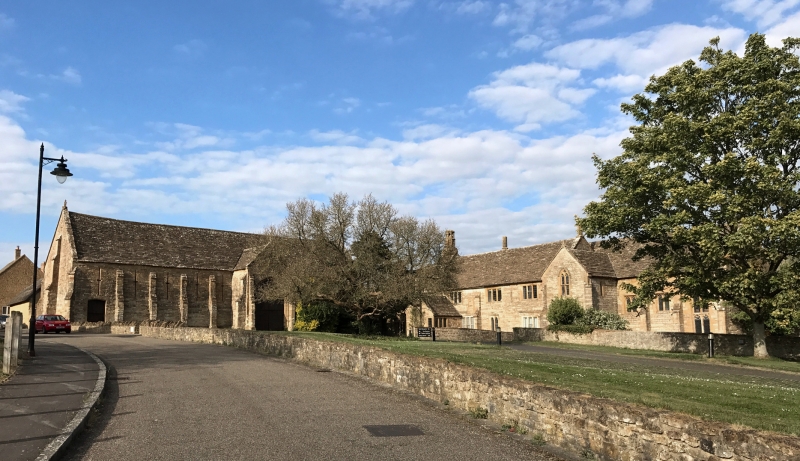
Farmhouse, now offices and yard of building contractors. Probably built c1420 by John Stourton II, known as Jenkyn. Ham Stone squared and tooled with worked ashlar dressings, stone slated roofs. Built on a North/South axis, the principal elevation faces West with hall on right-hand side, this has two 2- light mullioned windows set between offset buttresses and a (restored) dais window on extreme right hand; Next to hall is 2-storey porch, with 2-centred entrance arch, roll moulded square frame, no hood, blank shield and foliage in spandrels: Inside vault with ridge and diagonal ribs; stone benches, iron hinges. To left hand of porch 2-storey portion with mullioned windows to both levels: some C15, others as late as C19 - some doorways and windows now blocked. At North end of this block a wide wall with wide coping carrying fine C15 octagonal chimney, each side having a panel with trefoil head (a second tier damaged by bomb in 1940). North again further 2-storey building (? fodder store) not as high as main block, with outside steps. Projecting westwards from main block a C19 single storey addition. Internally (not fully inspected) the screens passage shows work of several periods. The hall, 12.2 x 6.5 metres had the roof lowered in the 1840's when the South chimney and upper part of dais window were removed: hall restored C1920 (after a fire) when much new material was introduced and the chimney and dais window restored, and an intermediate floor added. The North block much altered, leaving glimpes of old details. The variety of modern buildings on the East side, which completely masks the former East elevation, not of interest. Originally Preston Great Farm, always lay-ownership, ("Abbey" is a C19 misnomer), this is a hall house of considerable importance (Wood, Margaret: 'The English Medieval House' 1965 Garner, T.E. Stratton, A 'Domestic Architecture of England during the Tudor Period' 1929, also notes for SANHS by Sir R. de Z. Hall and E.H. Silcox).
Listing NGR: ST5365916254
External links are from the relevant listing authority and, where applicable, Wikidata. Wikidata IDs may be related buildings as well as this specific building. If you want to add or update a link, you will need to do so by editing the Wikidata entry.


Other nearby listed buildings