Latitude: 51.639 / 51°38'20"N
Longitude: -2.3475 / 2°20'50"W
OS Eastings: 376048
OS Northings: 193414
OS Grid: ST760934
Mapcode National: GBR 0MF.1BY
Mapcode Global: VH95G.82BC
Plus Code: 9C3VJMQ3+J2
Entry Name: Manor House
Listing Date: 30 June 1961
Grade: II
Source: Historic England
Source ID: 1054063
English Heritage Legacy ID: 128192
ID on this website: 101054063
Location: Wotton-under-Edge, Stroud, Gloucestershire, GL12
County: Gloucestershire
District: Stroud
Civil Parish: Wotton-under-Edge
Built-Up Area: Wotton-under-Edge
Traditional County: Gloucestershire
Lieutenancy Area (Ceremonial County): Gloucestershire
Church of England Parish: Wotton-under-Edge with Ozleworth
Church of England Diocese: Gloucester
Tagged with: House
ST 7693 4/121 WOTTON-UNDER-EDGE MANOR LANE 30.6.61 Manor House
II
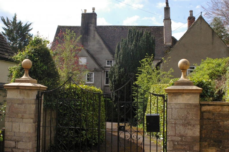
Detached dwelling. 1639. Rendered rubble, concrete tile roof. Large L-shaped house with two Cotswold gables to main facade and one to return; deep projecting wing to rear retains some stone slates. Three storeys two windowed plus small door and window, left; single or doubled sashes without bars under drip moulds with labels to ground and first floor; small oculus in gable tops, fixed lights, also on return gable: Six panel door. Interior includes plastered room with frieze of small heads reputedly by William Stocking; dining room egg and dart frieze. Formerly a Berkeley manor, then known as Lisle House; see Lindley, p 122 etc.
Listing NGR: ST7604893414
External links are from the relevant listing authority and, where applicable, Wikidata. Wikidata IDs may be related buildings as well as this specific building. If you want to add or update a link, you will need to do so by editing the Wikidata entry.


Other nearby listed buildings