Latitude: 52.5641 / 52°33'50"N
Longitude: -2.5946 / 2°35'40"W
OS Eastings: 359791
OS Northings: 296413
OS Grid: SO597964
Mapcode National: GBR BQ.CKYG
Mapcode Global: WH9DM.3TR6
Plus Code: 9C4VHC74+J5
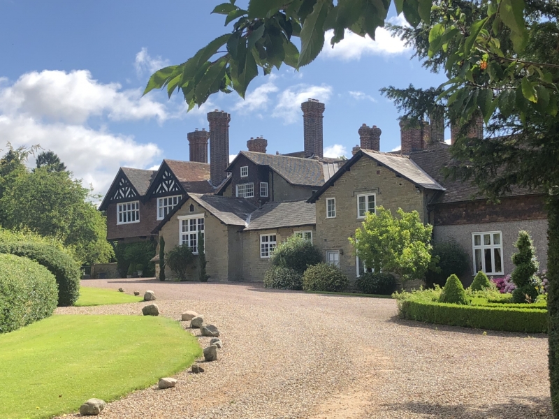
Entry Name: Bourton Manor
Listing Date: 24 October 1950
Grade: II
Source: Historic England
Source ID: 1053850
English Heritage Legacy ID: 254785
ID on this website: 101053850
Location: Bourton, Shropshire, TF13
County: Shropshire
Civil Parish: Much Wenlock
Traditional County: Shropshire
Lieutenancy Area (Ceremonial County): Shropshire
Church of England Parish: Much Wenlock with Bourton
Church of England Diocese: Hereford
Tagged with: Manor house
1. 1954 MUCH WENLOCK BOURTON
Bourton Manor SO 59 NE 12/96 24.10.50.
II
2. 1874 Architect, Norman Shaw. Characteristic of Shaw's large rambling multi-gabled houses in red brick and plasterwork. Embodies a stone cottage, probably C16, and a Queen Anne staircase.
Listing NGR: SO5979196413
External links are from the relevant listing authority and, where applicable, Wikidata. Wikidata IDs may be related buildings as well as this specific building. If you want to add or update a link, you will need to do so by editing the Wikidata entry.


Other nearby listed buildings