Latitude: 52.6643 / 52°39'51"N
Longitude: -2.3767 / 2°22'36"W
OS Eastings: 374618
OS Northings: 307468
OS Grid: SJ746074
Mapcode National: GBR 06S.ZX2
Mapcode Global: WH9DB.G9G9
Plus Code: 9C4VMJ7F+P8
Entry Name: Innage House
Listing Date: 26 May 1955
Grade: II
Source: Historic England
Source ID: 1053625
English Heritage Legacy ID: 255247
ID on this website: 101053625
Location: Shifnal, Shropshire, TF11
County: Shropshire
Civil Parish: Shifnal
Built-Up Area: Shifnal
Traditional County: Shropshire
Lieutenancy Area (Ceremonial County): Shropshire
Church of England Parish: Shifnal St Andrew
Church of England Diocese: Lichfield
Tagged with: House
SJ 7407-7507 SHIFNAL C.P. CHURCH STREET (North side)
10/30 Innage House. 26/5/55
GV II
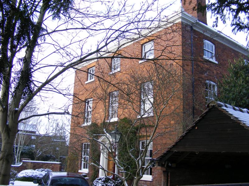
House. Mid C18. Red brick with hipped slate roof. L-plan. 3 storeys. Plinth, moulded plaster eaves cornice, blocking course to front with globe finials at ends, 2 stacks to left and right at rear, and ridge stack on wing to rear. 3 bays, glazing bar sashes with gauged heads. Central door with 6 raised and fielded panels, architrave, semi-circular fanlight with intersecting Gothic tracery, and doorcase consisting of Tuscan half columns supporting broken entablature and open triangular pediment. Side elevations of 2 bays with end pilaster strips and segmental headed glazing bar sashes with flush frames. Interior: C18 three-flight square well staircase rising both floors with landings, open string, turned balusters, moulded ramped handrail, column newels, twisted bottom newel, and wainscot panelling; arch in entrance hall with imposts, keystone and blank Gothic tracery in tympanum. B.O.E. Salop, p. 245.
Listing NGR: SJ7462407479
External links are from the relevant listing authority and, where applicable, Wikidata. Wikidata IDs may be related buildings as well as this specific building. If you want to add or update a link, you will need to do so by editing the Wikidata entry.


Other nearby listed buildings