Latitude: 51.8866 / 51°53'11"N
Longitude: -1.6465 / 1°38'47"W
OS Eastings: 424423
OS Northings: 220950
OS Grid: SP244209
Mapcode National: GBR 5RW.QK0
Mapcode Global: VHBZD.DVW3
Plus Code: 9C3WV9P3+J9
Entry Name: Bould Farmhouse
Listing Date: 15 May 1989
Grade: II
Source: Historic England
Source ID: 1053322
English Heritage Legacy ID: 253994
ID on this website: 101053322
Location: Bould, West Oxfordshire, OX7
County: Oxfordshire
District: West Oxfordshire
Civil Parish: Idbury
Traditional County: Oxfordshire
Lieutenancy Area (Ceremonial County): Oxfordshire
Church of England Parish: Fifield with Idbury
Church of England Diocese: Oxford
Tagged with: Farmhouse
IDBURY BOULD SP22SW 6/101 Bould Farmhouse
GV II
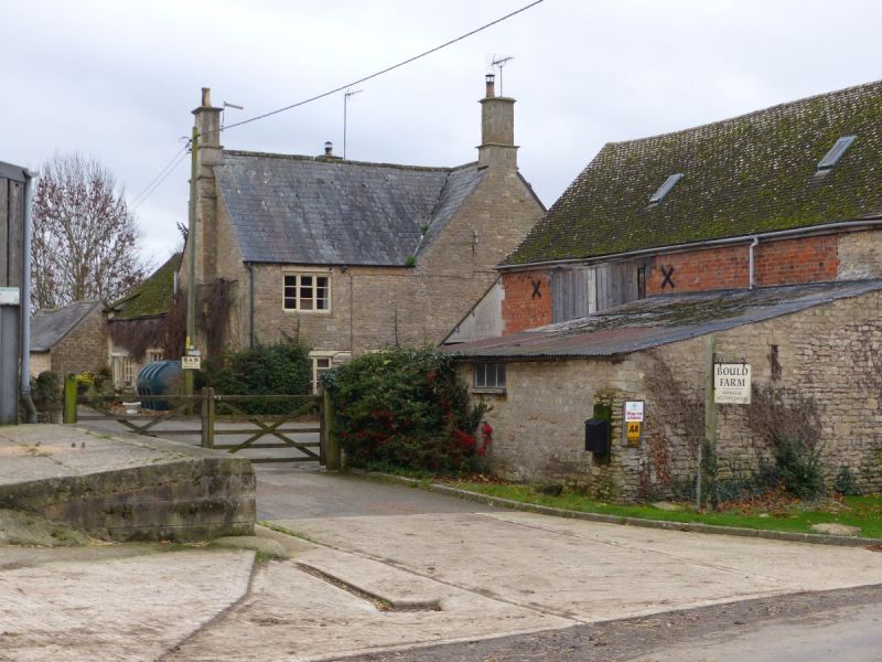
Farmhouse. Probably mid-to late C18 with C19 additions and alterations. Roughly coursed limestone rubble; slate and stone slate roofs. L-plan has low range parallel with main range in angle to rear. 2 storeys and attic. Slighly irregular 3-window front, C20 metal casements with wood lintels directly below eaves. Late C19 canted bay window with stone mullions to left and right of central half-glazed door under open flat-roofed porch. 3 late C19 gabled dormers in roof slope. Integral end stacks with moulded dripstones and capping. Lower range has 2 C19 casements directly below eaves, one to lower right and fixed-light window to lower left, both with wood lintels. Short rear range has external end stack. [2545]
Listing NGR: SP2442320950
External links are from the relevant listing authority and, where applicable, Wikidata. Wikidata IDs may be related buildings as well as this specific building. If you want to add or update a link, you will need to do so by editing the Wikidata entry.


Other nearby listed buildings