Latitude: 52.4578 / 52°27'28"N
Longitude: -2.3549 / 2°21'17"W
OS Eastings: 375979
OS Northings: 284491
OS Grid: SO759844
Mapcode National: GBR 09B.ZBY
Mapcode Global: VH91D.4HD5
Plus Code: 9C4VFJ5W+42
Entry Name: The Chantry
Listing Date: 9 March 1970
Grade: II
Source: Historic England
Source ID: 1053194
English Heritage Legacy ID: 254285
ID on this website: 101053194
Location: Alveley, Shropshire, WV15
County: Shropshire
Civil Parish: Alveley
Built-Up Area: Alveley
Traditional County: Shropshire
Lieutenancy Area (Ceremonial County): Shropshire
Church of England Parish: Alveley
Church of England Diocese: Hereford
Tagged with: Building
1. 1954 ALVELEY ALVELEY CENTRE PLACE
No 4 (The Chantry) SO 78 SE 33/6 9.3.70.
II GV
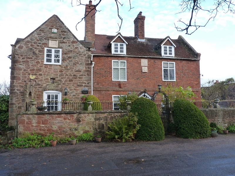
2. Dated 1706 and 1725, later alterations, Whitewashed brick plaintile roof; restored brick stacks; coped end gable to right-hand. Two-storey, 2 windows, later diamond-paned casements, keyed lintels to 1st floor; central square- headed doorway with gabled hood; plain brick band at 1st floor level; stone tablet between upper windows inscribed with initials and date 1725; earlier gabled projecting wing to left-hand, whitewashed rubble, plain-tiles, stone coping to gable; 2-storey plain central door; later casement to upper floor; stone tablet above inscribed with initials and date 1706. Poor later features to south end elevation. Church of St Mary. Churchyard Cross and walls, and all the buildings in Centre Place form a group.
Listing NGR: SO7597984490
External links are from the relevant listing authority and, where applicable, Wikidata. Wikidata IDs may be related buildings as well as this specific building. If you want to add or update a link, you will need to do so by editing the Wikidata entry.


Other nearby listed buildings