Latitude: 51.8477 / 51°50'51"N
Longitude: -1.3559 / 1°21'21"W
OS Eastings: 444465
OS Northings: 216763
OS Grid: SP444167
Mapcode National: GBR 7WJ.01R
Mapcode Global: VHCX6.GT1F
Plus Code: 9C3WRJXV+3J
Entry Name: Thistle House
Listing Date: 13 February 1969
Last Amended: 27 July 1988
Grade: II
Source: Historic England
Source ID: 1052850
English Heritage Legacy ID: 253131
ID on this website: 101052850
Location: Woodstock, West Oxfordshire, OX20
County: Oxfordshire
District: West Oxfordshire
Civil Parish: Woodstock
Built-Up Area: Woodstock
Traditional County: Oxfordshire
Lieutenancy Area (Ceremonial County): Oxfordshire
Church of England Parish: Woodstock
Church of England Diocese: Oxford
Tagged with: House
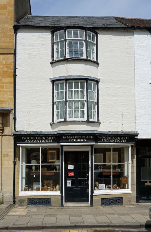
WOODSTOCK MARKET PLACE SP4416NW (North side) 91/139 No.12 (Thistle House) and 13/02/69 No.14 (Formerly listed as No.12 and 14) GV II Two houses. Early C19, incorporating shell of earlier house to left. Colourwashed limestone rubble and right bay of brick; gabled Welsh slate roof to left, and concrete tile roof to right; brick right end stack, and rear lateral stack to left. 2-unit plan. 3 storeys; 2-window range. Early C19 bracketed cornice over late C19 half-glazed door with overlight and canted bay window to right (No.12). To left, moulded cornice over late C19 square bay windows flanking half-glazed door. 2-storey oriel windows: canted window on right has glazing bar sashes; bow window on left has similar sashes with slender columns. Interior of No.14: early C19 ducks-nest grate and straight-flight staircase. No.12 not inspected.
Listing NGR: SP4446516763
External links are from the relevant listing authority and, where applicable, Wikidata. Wikidata IDs may be related buildings as well as this specific building. If you want to add or update a link, you will need to do so by editing the Wikidata entry.


Other nearby listed buildings