Latitude: 51.9427 / 51°56'33"N
Longitude: -1.5448 / 1°32'41"W
OS Eastings: 431385
OS Northings: 227230
OS Grid: SP313272
Mapcode National: GBR 6SS.08M
Mapcode Global: VHBZ8.5FNL
Plus Code: 9C3WWFV4+33
Entry Name: Guildhall
Listing Date: 23 April 1952
Grade: II
Source: Historic England
Source ID: 1052632
English Heritage Legacy ID: 251670
ID on this website: 101052632
Location: Chipping Norton, West Oxfordshire, OX7
County: Oxfordshire
District: West Oxfordshire
Civil Parish: Chipping Norton
Built-Up Area: Chipping Norton
Traditional County: Oxfordshire
Lieutenancy Area (Ceremonial County): Oxfordshire
Church of England Parish: Chipping Norton with Over Norton
Church of England Diocese: Oxford
Tagged with: City hall Seat of local government
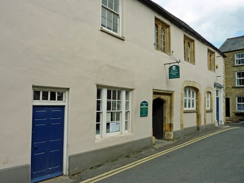
CHIPPING NORTON MIDDLE ROW SP 3027-3127 (east side) 3/58 Guildhall 23.4.52 GV II Former Guildhall, now council offices. Circa 1500-20, extended in the early C18 and the C19 of rubblestone covered with roughcast, stone dressings and a stone tiled roof gabled at the N end and half hipped at the S. Originally a 3-bay first floor hall with a 2-bay early C18 S extension and a one-bay C19 N addition. Externally the early C16 features on the hall section are 2-light mullions with Tudor arched heads to the E and a 3-light mullion on the W rear wall. At ground floor level on the E front is a doorway with a four-centred head, spandrels carved with quatrefoils and mouchettes and chamfered jambs. Other features on this front include an early C18 depressed archway. Inside the hall section has an early C16 timber roof structure with 2 bays of principal rafters, collars and arch- bracing corbels and trenched purlins.
Listing NGR: SP3138527230
External links are from the relevant listing authority and, where applicable, Wikidata. Wikidata IDs may be related buildings as well as this specific building. If you want to add or update a link, you will need to do so by editing the Wikidata entry.


Other nearby listed buildings