Latitude: 53.3232 / 53°19'23"N
Longitude: -1.9157 / 1°54'56"W
OS Eastings: 405709
OS Northings: 380704
OS Grid: SK057807
Mapcode National: GBR HZ20.1F
Mapcode Global: WHBBD.JQYQ
Plus Code: 9C5W83FM+7P
Entry Name: Market Cross
Listing Date: 12 April 1984
Grade: II
Source: Historic England
Source ID: 1052216
English Heritage Legacy ID: 82022
ID on this website: 101052216
Location: Chapel-en-le-Frith, High Peak, Derbyshire, SK23
County: Derbyshire
District: High Peak
Civil Parish: Chapel-en-le-Frith
Built-Up Area: Chapel-en-le-Frith
Traditional County: Derbyshire
Lieutenancy Area (Ceremonial County): Derbyshire
Church of England Parish: Chapel-en-le-Frith St Thomas a Becket
Church of England Diocese: Derby
SK 05 80 TOWN OF CHAPEL-EN-LE-FRITH MARKET PLACE 8/43 (South Side) Market Cross GV II
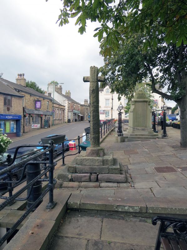
Market cross. c1643. Gritstone. Three stepped square base. Square, slightly tapering and partly chamfered pier, approximately 8 feet high. Latin type head. A Scheduled Ancient Monument. Kellys Directory of 1904 refers to the cross being dated 1643.
Listing NGR: SK0570980704


Other nearby listed buildings