Latitude: 52.6397 / 52°38'22"N
Longitude: 1.5483 / 1°32'53"E
OS Eastings: 640166
OS Northings: 310568
OS Grid: TG401105
Mapcode National: GBR XK7.G89
Mapcode Global: WHMTK.RXG7
Plus Code: 9F43JGQX+V8
Entry Name: The Manor House
Listing Date: 25 September 1962
Grade: II
Source: Historic England
Source ID: 1051480
English Heritage Legacy ID: 228579
ID on this website: 101051480
Location: Acle, Broadland, Norfolk, NR13
County: Norfolk
District: Broadland
Civil Parish: Acle
Built-Up Area: Acle
Traditional County: Norfolk
Lieutenancy Area (Ceremonial County): Norfolk
Church of England Parish: Acle
Church of England Diocese: Norwich
Tagged with: House
This list entry was subject to a Minor Amendment on 20 August 2024 to amend the details in the description and reformat the text to current standards
TG 41 SW
2/3
ACLE
THE GREEN (north side)
The Manor House.
25.9.62
G.V.
II
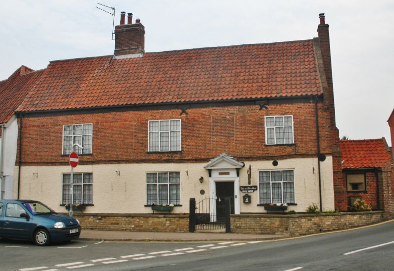
House. C17 with possibly earlier core. Red brick with ground storey rough cast. Pantiled roof. Two storeys and attic. Three window range, widely-spaced; C19 three-light casements with transom. Leaded glazing. Off-centre six panelled entrance door with shouldered architrave supporting pediment on consoles. Blocked window opening above door. Plat band at first floor level. Off-centre axial chimney stack. East gable parapeted with continuous tumbling-in and moulded brick kneelers. External brick gable stack. Attached to the east gable is a red brick outbuilding which had a World War II pill box installed within it to protect the entrance to the Old Yarmouth Road. Pantiled catslide to north; sloping pantiled dormer with two-light leaded casement.
Listing NGR: TG4016610568
External links are from the relevant listing authority and, where applicable, Wikidata. Wikidata IDs may be related buildings as well as this specific building. If you want to add or update a link, you will need to do so by editing the Wikidata entry.


Other nearby listed buildings