Latitude: 52.3739 / 52°22'26"N
Longitude: 1.2341 / 1°14'2"E
OS Eastings: 620244
OS Northings: 280020
OS Grid: TM202800
Mapcode National: GBR VKG.0W4
Mapcode Global: VHL99.BLSJ
Plus Code: 9F4396FM+HM
Entry Name: The Grange
Listing Date: 19 September 1957
Grade: II*
Source: Historic England
Source ID: 1049632
English Heritage Legacy ID: 225064
ID on this website: 101049632
Location: Thorpe Abbotts, South Norfolk, IP21
County: Norfolk
District: South Norfolk
Civil Parish: Brockdish
Traditional County: Norfolk
Lieutenancy Area (Ceremonial County): Norfolk
Church of England Parish: Brockdish St Peter and St Paul
Church of England Diocese: Norwich
Tagged with: Building
1. 5321 BROCKDISH GROVE ROAD (north end) The Grange TM 28 SW 21/4 19.9.57
II*
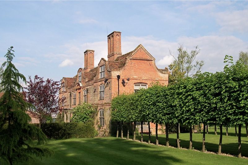
2. Dated 1676. Fine brick house. Steep tiled roof with pedimented Dutch end gables. Two storeys and attic. l:3:1 bays, centre and end bays have Dutch gables, the end bays advanced slightly. Brick string courses at floor levels. Segmental headed window openings with keyblocks, replacement mullion/transom casements with leaded panes. Central first floor brick pilastered window with moulded brick segmental pediment and moulded brick panel inscribed "SSM 1676". Below is the central heavy moulded doorcase with panelled door and portico porch with bulbous Ionic columns supporting entablature with pulvinated frieze. Left and right of centre 2 large brick chimney stacks with moulded cornices and moulded bases, and round-headed recessed panel sides. Gabled staircase wing at rear off centre. Said to contain original staircase.
Listing NGR: TM2024480020
External links are from the relevant listing authority and, where applicable, Wikidata. Wikidata IDs may be related buildings as well as this specific building. If you want to add or update a link, you will need to do so by editing the Wikidata entry.


Other nearby listed buildings