Latitude: 52.7674 / 52°46'2"N
Longitude: 1.5168 / 1°31'0"E
OS Eastings: 637346
OS Northings: 324667
OS Grid: TG373246
Mapcode National: GBR XHN.DBG
Mapcode Global: WHMSZ.8PKT
Plus Code: 9F43QG88+XP
Entry Name: The Old Granary
Listing Date: 30 September 1987
Grade: II
Source: Historic England
Source ID: 1049368
English Heritage Legacy ID: 223703
ID on this website: 101049368
Location: Stalham, North Norfolk, NR12
County: Norfolk
District: North Norfolk
Civil Parish: Stalham
Built-Up Area: Stalham
Traditional County: Norfolk
Lieutenancy Area (Ceremonial County): Norfolk
Church of England Parish: Stalham and East Ruston with Brunstead
Church of England Diocese: Norwich
Tagged with: Granary
TG 32 SE STALHAM STAITHE ROAD
5/68 The Old Granary
II
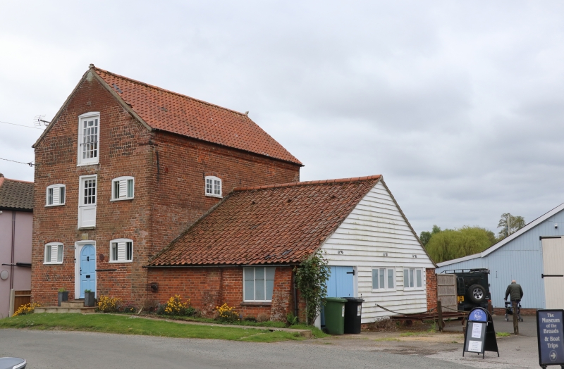
Wherry granary, now private house. Dated S.C.S. 1808, restored 1977 by Anthony C. Adcock. Brick with pantile roof. 3 storey facade in north-east gable. Symmetrical. Central round arched panelled door in square surround approached by short flight of steps. To left and right one segmental 3-light window, the central light louvred. Central first floor access door to granary, now half glazed. 2 similar windows above those to ground floor. Loading door in attic, now also half glazed. Gabled roof. Rear gable weatherboarded. Staithe runs underneath building to form wherry bays, the floor beams carried on arched braces. Above is 3 storey symmetrical facade. Ground floor with central glazed C20 door flanked by one leaded casement each side. First floor with 2 tiers of leaded casements, the lower tier 2- light, the upper tier 4-light. 4-light attic casement also with leaded lights. Interior retains all bridging beams, joists and timbering. Granary bays with plank walls. All casements original iron type. Roof of tie beams, one tier clasped purlins and collars. An excellent example of rare industrial building.
Listing NGR: TG3734624667
External links are from the relevant listing authority and, where applicable, Wikidata. Wikidata IDs may be related buildings as well as this specific building. If you want to add or update a link, you will need to do so by editing the Wikidata entry.


Other nearby listed buildings