Latitude: 51.6574 / 51°39'26"N
Longitude: -1.5876 / 1°35'15"W
OS Eastings: 428623
OS Northings: 195481
OS Grid: SU286954
Mapcode National: GBR 5VW.1FD
Mapcode Global: VHC0L.FLKT
Plus Code: 9C3WMC46+XX
Entry Name: Westbrook House
Listing Date: 10 November 1952
Grade: II
Source: Historic England
Source ID: 1048463
English Heritage Legacy ID: 249392
ID on this website: 101048463
Location: Faringdon, Vale of White Horse, Oxfordshire, SN7
County: Oxfordshire
District: Vale of White Horse
Civil Parish: Great Faringdon
Built-Up Area: Faringdon
Traditional County: Berkshire
Lieutenancy Area (Ceremonial County): Oxfordshire
Church of England Parish: Faringdon
Church of England Diocese: Oxford
Tagged with: House
GREAT FARINGDON GRAVEL WALK SU 2895
3/38 No 18 (Westbrook House)
10.11.52
- II
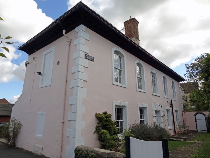
Substantial early C18 stucco faced house. Rubble stone. L plan, 2-storey and attic with large hipped roof partly stone tiled, modern tiles to front. Large brick ridge stack on chequered brick and stone base to front range, similar stack on rear wing. Moulded wood dentil eaves cornice. West front: 5-window range, angle quoins, cambered head windows to 1st floor, 4 windows, flat head to centre and ground floor windows. Plain raised surrounds, eared architrave to centre 1st floor, keystones to ground floor. Central heavily block-rusticated door surround with triple keystone. South side: 6-window range to 1st floor with outer pair blank. 3 windows to ground floor with flanking doors. Plain raised surrounds with flat heads and keystones. One 4-light gabled dormer. Rear rubble stone with staircase block in angle with hipped plain tile roof. Interior: Heavy moulded handrail to stair, twisted balusters and some fielded panelling. Said to have date 1705 on interior wall. P J Goodrich: Great Faringdon Past and Present 1928.
Listing NGR: SU2862395481
External links are from the relevant listing authority and, where applicable, Wikidata. Wikidata IDs may be related buildings as well as this specific building. If you want to add or update a link, you will need to do so by editing the Wikidata entry.


Other nearby listed buildings