Latitude: 51.6582 / 51°39'29"N
Longitude: -1.5857 / 1°35'8"W
OS Eastings: 428754
OS Northings: 195575
OS Grid: SU287955
Mapcode National: GBR 5VP.V8Y
Mapcode Global: VHC0L.GLK5
Plus Code: 9C3WMC57+7P
Entry Name: Gloucester House
Listing Date: 10 July 1986
Grade: II
Source: Historic England
Source ID: 1048458
English Heritage Legacy ID: 249379
ID on this website: 101048458
Location: Faringdon, Vale of White Horse, Oxfordshire, SN7
County: Oxfordshire
District: Vale of White Horse
Civil Parish: Great Faringdon
Built-Up Area: Faringdon
Traditional County: Berkshire
Lieutenancy Area (Ceremonial County): Oxfordshire
Church of England Parish: Faringdon
Church of England Diocese: Oxford
Tagged with: House
GREAT FARINGDON GLOUCESTER STREET SU 2895 (north side)
3/27 No 8 (Gloucester House)
-
GV II
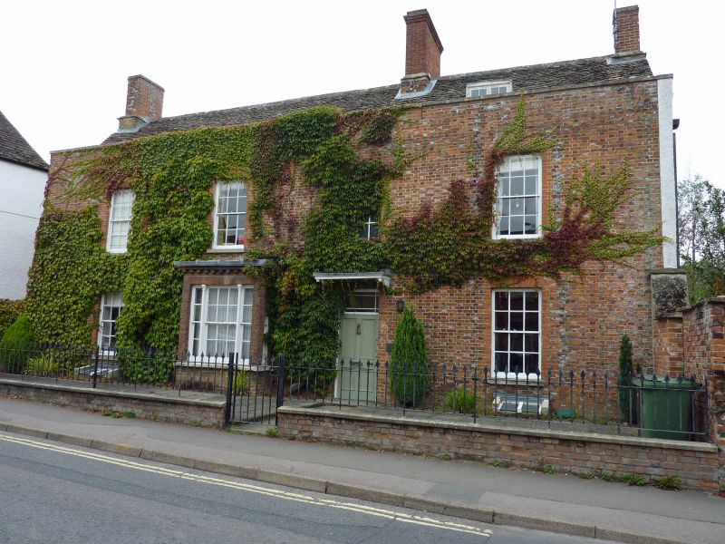
Earlier C17 rubble stone house with early C19 chequered brick front. 2-storey and attic, stone tiled roof with large west end wall stack, ridge stack and one cambered head dormer. Early C19 brick south front 2-storey with parapet, 4-window range of glazing bar sash windows. Gauged brick window heads. Door with hood on slim brackets and adjoining small later projecting bay. North front: roughcast and stone with central stair gable with 3-light stone mullioned windows to 1st and 2nd floors. One window range each side, to left early C18 projection with hipped roof and thick barred sash window to 1st floor in beaded plain stone surround. To right wall built out to line of central gable. One 16-pane sash above and iron casement with leaded lights below. Rear wing at west end with large rubble stone end wall stack and 4-light stone mullioned window on west side ground floor. Modern extension beyond.
Listing NGR: SU2875095582
External links are from the relevant listing authority and, where applicable, Wikidata. Wikidata IDs may be related buildings as well as this specific building. If you want to add or update a link, you will need to do so by editing the Wikidata entry.


Other nearby listed buildings