Latitude: 51.6844 / 51°41'3"N
Longitude: -1.1422 / 1°8'31"W
OS Eastings: 459398
OS Northings: 198751
OS Grid: SU593987
Mapcode National: GBR 902.61Z
Mapcode Global: VHCY3.5X0M
Plus Code: 9C3WMVM5+Q4
Entry Name: Chiselhampton Bridge
Listing Date: 18 July 1963
Grade: II
Source: Historic England
Source ID: 1048022
English Heritage Legacy ID: 248364
ID on this website: 101048022
Location: Chiselhampton, South Oxfordshire, OX44
County: Oxfordshire
District: South Oxfordshire
Civil Parish: Stadhampton
Traditional County: Oxfordshire
Lieutenancy Area (Ceremonial County): Oxfordshire
Church of England Parish: Stadhampton with Chiselhampton
Church of England Diocese: Oxford
STADHAMPTON B480 SU5998 Chiselhampton 13/123 Chiselhampton Bridge 18/07/63
GV II
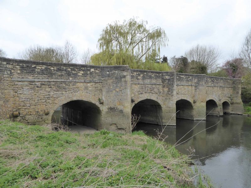
Bridge. Probably late Cl6, partly rebuilt after Civil War and widened C20. Limestone rubble with squared dressings and some ashlar at lower level. East face has irregularly-spaced triangular cutwaters and 8 eliptical arches. The parapet and the whole of the west face are C20. (V.C.H.: Oxfordshire, Vol. VII, p.5).
Listing NGR: SU5939898751


Other nearby listed buildings