Latitude: 51.6981 / 51°41'53"N
Longitude: -1.18 / 1°10'48"W
OS Eastings: 456765
OS Northings: 200243
OS Grid: SP567002
Mapcode National: GBR 8ZT.GGV
Mapcode Global: VHCY2.HLJ3
Plus Code: 9C3WMRX9+6X
Entry Name: Church of St Lawrence Group of 3 Chest Tombs Approximately 2 Metres to South
Listing Date: 19 August 1986
Grade: II
Source: Historic England
Source ID: 1047996
English Heritage Legacy ID: 248409
ID on this website: 101047996
Location: St Lawrence's Church, Baldon Row, South Oxfordshire, OX44
County: Oxfordshire
District: South Oxfordshire
Civil Parish: Toot Baldon
Traditional County: Oxfordshire
Lieutenancy Area (Ceremonial County): Oxfordshire
Church of England Parish: Marsh Baldon with Toot Baldon and Nuneham Courtenay
Church of England Diocese: Oxford
Tagged with: Chest tomb
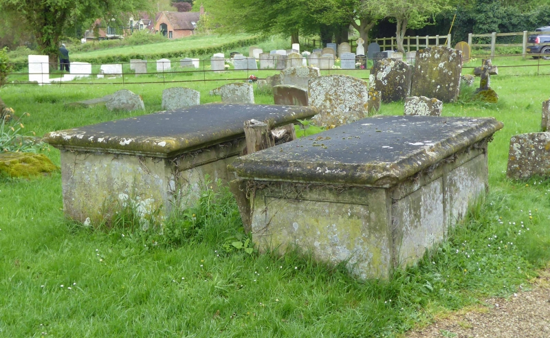
TOOT BALDON SP5600 8/171 Church of St. Lawrence, group of 3 chest tombs approx. 2m. to S
GV II
3 chest tombs. Late C18. Limestone. Pair of tombs to south-west of porch have moulded covers and panelled sides. Insciptions illegible. Tomb to south-east of porch has a moulded base and cover, rectangular corner balusters, and panelled sides with traces of a painted finish. Earliest inscription commemorates John Fruin (died 1791).
Listing NGR: SP5676500243
External links are from the relevant listing authority and, where applicable, Wikidata. Wikidata IDs may be related buildings as well as this specific building. If you want to add or update a link, you will need to do so by editing the Wikidata entry.


Other nearby listed buildings